Many images are "clickable" - run the mouse over them and if a "hand" appears then click & a larger version will open in a new window!
Page Index.
|
Kerb guidance is an off road technology which involves the creating of private rights of way (for buses) using a special trackway physically removed from the public highway. The first public kerb guided busway (KGB) opened in Essen, Germany in 1980, although Mercedes had previously demonstrated the concept at the 1979 international traffic exhibition (IVA) in Hamburg. In Germany the KGB system is often referred to as "O-Bahn", although the terms "Bahnbus" and "Spurbus" are also used. The KGB trackway is similar - in theme - to conventional railway tracks except that instead of being designed for flanged steel wheeled trains / trams / streetcars it is designed for rubber tyred road vehicles. Essen‘s first installation features parallel sets of 'L' shaped prefabricated concrete panels which are 10m (metres) in length and laid 2.60m apart (as measured on inside vertical faces). For curved sections of trackage (guideway) the panels were gently bent as required whilst being laid. They are supported every 1.35m by sleepers to which they are fixed by means of fishplates and clamps. The sleepers are wide enough for both direction‘s tracks and are mounted on to concrete bore piles which act as the foundation. To make it easier for buses to enter the trackage the entry points are fitted with steel box girders which funnel in from 3.50m down to 2.60m. |
|||
 |
 |
||
| Busway trackage on the Fulerumer Strasse section of busway (the first section to be opened). | The buses' road-wheels use the road surface, and the guide-wheels run along the inside face of a raised kerb (as seen on a British guided bus). |
||
|
Kerb guidance uses ordinary buses (motorbus, trolleybus, etc,.) fitted with two horizontal guide-wheels (one per side, mounted immediately in front of the front road wheels) which steer the vehicle via guide-arms attached to the steering knuckle. The buses' road-wheels use the bottom leg of the precast panels, and the guide-wheels run along the 18cm (approx 6") high upstand edge. |
|||
Depending on the sharpness of the curved trackage there is sometimes a need for additional touch-wheels to be fitted next to the vehicles' rear wheels (plus, on articulated buses, centre wheels). This is to ensure that the sides of the buses' (centre and) rear road wheels do not make physical contact with the guidewalls. Whilst on the track the driver retains full control of the vehicle except that (s)he no longer needs to use the steering wheel! Away from the track the bus uses the normal road, just like any other rubber tyred road vehicle. |
 Side elevation of an articulated kerb guided duo-bus showing the extra touch-wheels fitted next to the centre and rear axles. These are more easily seen on the clickable image, which when seen full screen will need scrolling sideways. |
||
|
The reasoning for mechanically guiding buses is that the resulting dedicated busway uses less space (land width) so can be much narrower than a driver steered busway. To allow for driver-steered buses to "wander" sideways slightly and still pass safely when travelling at even a moderate speed an ordinary two lane road needs to be at least 7.5 - 8 metres in width. However for guided buses the lanes only need to be a little wider than the buses, so for standard width buses of 2.5 metres (or 2.55 metres) the total width required for a two-way busway will be only 6 metres. The resulting saved space can make a significant difference when trying to shoehorn a dedicated bus lane in to a narrow strip of land. |
|||
 |

Above: Map showing the proposed Dual-Mode-Bus demonstration system Left: Installing the trackage on the Fulerumer Strasse section of busway. Both images sourced from an official brochure on the 'Dual-mode-bus' project. |
||
Why Was Kerb Guidance Created?Essen‘s O-Bahn system was part of an experiment in bus transport started in the late 1970‘s whereby the (West) German Government Federal Ministry of Research and Technology funded a developmental project to perfect two recent German designed innovations in bus transport - the ‘self-steering’ kerb guided bus and the twin system 'duo-bus'* - by means of a phased programme of testing and evaluation over two (later became three) quiet suburban private rights of way which, if successful, could eventually be linked up via the city centre to provide a 'dual-mode-bus' demonstration system. |
|||
The rational behind the experiment was that over recent decades Essen, like many other West German cities,
had followed a policy of upgrading metre gauge street tramways into standard gauge light railways and in congested city centres relocating both modes
into underground tunnel systems. Its buses however remained on the surface, and as might be expected at times of peak traffic flow the delays often
caused considerable disruption to services. Having built expensive infrastructure for the steel wheeled transports it was felt desirable to try to maximise
the benefits of that expenditure by extending the buses through the tunnels too. |
 Unfenced busway alongside a pedestrian footpath and the tree-lined Fulerumer Strasse. This line was introduced as an alternative to widening the road, something that local people did not want. NB: The clickable large image has been sourced from S-VHS-C videotape and is a little fuzzy. |
||
|
|||
 |
 |
||
| A car takes advantage of the gap in the trackage provided to allow access to a 'local access' road on the left of this picture. Beyond the gap are the platforms for the Suedwest-Friedhof Haupteingang bus stop. The signal with the white stripe is for the buses. | Same location, but opposite viewpoint, showing a bus waiting at the signal. | ||
 |
 |
||
| As with many surface level kerb guided bus stops the Suedwest-Friedhof Haupteingang bus stop features low level platforms and ramped access. | In this 1996 view the evening sun casts long shadows over disused trackage on a closed section of surface busway along Wickenburgstrasse. However since then the northbound (right-hand) track has reopened as it lets buses pass queues leading up to a busy road junction. | ||
The route to Kray was not part of the original plans but was added because the trams were blamed for traffic congestion in Kray and as Federal Government money was available (ie: someone else would foot the bill!) it was thought to be cheaper to replace them than relocate the tracks onto private rights-of-way away from the road traffic. The main guided section is located in the median strip of the A430 Ruhrschnellweg Krayer Strecke urban motorway (in 1992 this became the A40). It was decided that for health reasons within Kray‘s narrow streets the duo-buses would operate in zero emission trolleybus mode. This was fortunate because the one aspect of the bustitution of this section of tram route 103 that had alarmed the planners was the inevitability of more motor vehicle exhaust fumes, especially in Kray‘s narrow streets, some of which are usually thronged with shoppers. It is worth pointing out that on the duo-buses the waste gas outlet is at the back bottom left corner, just about the same height as a child sitting in a pushchair. As an aside, the same issue applies to many British diesel buses too - although the exact locations at the bottom back of the bus vary. |
|||
 |
 |
||
| Most of the bus stops in the A430 (now A40) ‘Ruhrschnellweg‘ Krayer Strecke urban motorway are reached from roads located underneath, with steps leading up to them; Feldhaushof is different in that it is accessed via a footbridge. From this superb photospot we see Duo-bus 3727 on an eastbound service from Haarzopf Erbach heading towards Kray, having already passed through the city centre and the kerb guided busway at Fulerumer Strasse. | It was decided that for health reasons within Kray‘s narrow streets (some of which are partially pedestrianised) the duo-buses would operate in zero emission trolleybus mode - this vehicle is at Kray Nord, which is where the route terminated. | ||
 |
 |
||
| Most of the trackage on the approximately 3.5km (a little under 2¼ miles) busway to Kray is of the 'prefabricated concrete panels' type, as used on the original installation along Fulerumer Strasse, however at some of the stops located en route there are very short sections where the guideway forms ‘s’ bends (to direct it to the opposite side of the median strip, thereby providing the required space for the stop‘s staggered platforms) and at these locations the trackage is formed by a concrete mass road surface into which upstanding metal guidewalls are set. | Schematic and two images of the Kray route whilst under construction.
Although proposed the installation of overhead wires for kerb guided trolleybus operation was not actually carried out. Image sourced from an official brochure on the ‘Dual-mode-bus’ project. |
||
 |
 |
||
| A montage of images from Mercedes O-Bahn promotional material. The top image shows the ramp at Kray, lower right shows the ramp near the Wasserturm (Water Tower) stop in Essen and the lower left image shows a tunnel entry ramp near a kerb guided trolleybus & stop named Volkshochschule. | Looking out the front window of a bus on the busway towards Kray. The signal shows the speed at which the vehicle must travel to catch a green light at the traffic signals located at the end of the up ramp (seen in distance) which leads back onto the public highway in Kray. | ||
The access ramps are fairly steep and when the busway first opened wintry weather saw them become blocked by snow which had compacted under the wheels of the passing buses and this caused the service to be suspended until it could be broken up and removed by hand. As a result it became necessary to equip them with electric heating. |
|||
 |
A short (under 100m) combined tramway & kerb guided busway at the Wasserturm (Water Tower) stop which is located
just before the buses diverge on to the busway towards Kray. The tram on the left is on the city-bound lane which is used by both trams & guided buses; the bus is in a bus-only guided busway where it can await its traffic signal (to turn left & on to the busway) without delaying the trams which continue straight ahead and have their own lane on the far side of the island platform. |
||
As part of a policy of testing everything on the surface before installing in tunnels the section of guided busway on Wittenbergstrasse included trials of three different types of joint guided busway and tramway trackage, a kerb guided bus point (‘switch’ in the American dialect) plus two types of overhead wire supports to simulate where guided trolleybuses would share the tram tunnels. For these trials the trolleybus overhead was energised at 600v dc, using the same rectifier substations as the trams. However it was decided that since the duo-buses were really intended to operate at 750v dc (and the trams use 600v dc) so for tunnel operations it would be best that the two transports would use separate rectifier substations. The first two photographs (below) show the two different overhead wire systems that were developed - the first picture shows the version used in 'curved roof' tunnels and how it included a simulation of such a tunnel roof; the second picture shows the arrangement designed for surface sections of track sharing. Below that is an image showing the points. These three sets of images have been sourced from an official brochure on the 'Dual-mode-bus' project. The duo-buses involved in these trials were a Mercedes-Benz O 305 GTD and a MAN SG 240 H Duo. In addition, there was a short section of overhead wiring at the bus garage, this was for test drives. Nowadays all overhead wires have been removed from this location, as have tram services too. |
|||
 Overhead wire support arrangement being trialed for 'curved roof' tunnels. |
|||
 Overhead wire support arrangement being trialed for ‘surface’ sections of track sharing. |
|||
 Experimental kerb guided bus points (switches). It is assumed that the image on the far right shows a variant installed in the yard at a bus garage. |
|||
 |
 |
||
| In the days when the overhead wires were still in place two buses travelling towards Stadwaldplatz call at the Wittenbergstrasse kerb guided busway stop. | The same location (a few years later) as seen from the front of a bus whilst waiting for the signals to change. The wait can often seem interminable and as a result if there are two buses here they often go through in convoy. | ||
 |
 |
||
| An equestrian crossing, with gaps in the guidewalls on the kerbside. Riders request the lights to change using special extra high 'horse level' push buttons (not shown). | Also tested here was one of the initial fleet of Leeds kerb guided buses. Image courtesy of Dr Tebb. |
||
 |
 |
||
 |
A selection of five images sourced from the official brochure on the 'Dual-mode-bus' project showing the section of guided busway on Wittenbergstrasse. These date from the testing phase when kerb guided duo/trolleybuses were sharing the route with trams. As other images here suggest, nowadays this section of guided busway is only served by diseasal motorbuses and the trackage has been rebuilt without the tram rails. |
||
 |
 |
||
For tunnel operation the buses also had to be able to interact with the signalling system and after a few hiccups - which always failed ‘safe’ but were still nuisances - the technology became reliable. |
|||
 |
 |
||
| Joint guided bus and tram trackage showing a signalling system 'detector' for the buses. Trams use the interaction between the steel wheels and rails to control signalling systems - this is not an option with rubber-tyred buses! Seen at an entry point to the tunnel section - the "H" sign indicates where a second tram or bus should stop and await a green (proceed) signal should two services arrive at the same time. |
Side elevation of the back of a guided bus, showing the special magnet fitted on the lower skirt - this formed a part of the signalling system designed to confirm that a bus had safely left a signalling 'block'. | ||
|
Apart from signalling another important safety issue concerned what might happen if the tram catenary broke and fell on to a bus. It was reasoned that if one wire fell on to the bus, the chances are that the other end of the breakage could still fall somewhere where it would trigger the circuit breakers to cut off the power. But what if both ends fell onto the bus? Again it was reasoned that by virtue of the buses' rubber tyres there would be no circuit to earth and even though this would mean that the circuit breakers would not be triggered the people in the bus would remain safe - as long as they remained in the bus! If, however, someone outside the bus touched it (or a passenger tried to alight at a stop) then it could be that the full line voltage would use them as a route to earth, resulting in the almost certain probability of a serious electric shock - or worse. So as an extra safety measure all the duo-buses were fitted with metal skates which automatically lower on to a tram rail when the vehicle‘s speed is less than 3 km/h. Under normal circumstances a safety interlock will prevent the passenger doors from opening until after the earthing device has been lowered (the driver is advised of correct operation) however in case of malfunction the driver has an override control. The driver also has the ability to manually raise the earthing device (in case the vehicle‘s pneumatics fail) as otherwise it would render the vehicle immobile - an undesirable situation which would result in a blocked tunnel. |
|||
 |
 |
||
| The first tunnel section of tunnel operation saw buses calling at Porscheplatz station where they shared the centre two tracks with the trams. | View under the front of a guided duo-bus showing the front guide-wheel and 'earthing skate' in lowered position. Image sourced from an official brochure on the 'Dual-mode-bus' project. | ||
 |
 |
||
| Above and Below Guided duo-buses in electric mode, sharing formation with trams in Essen city centre. In 1991 this location was replaced by a new extension to the tram tunnel system. |
|||
 |
 |
||
| The eastern extremity of the tunnel was (and still is, for the trams) a stop named the Volkshochschule. | This photograph of the entry point clearly shows how that to make it easier for buses to enter the trackage the side guidewalls funnel in. | ||
|
The extension to the underground system which opened in September 1991 included two underground stations which featured central island platforms that required the passengers to use the duo-buses' off-side doors. |
|||
 |
 |
||
| These views come from Berliner Platz, the black and white chequer on the tunnel wall indicates the stopping position for the buses and single-unit trams. | |||
 |
 |
||
| This is Rheinisher Platz, which replaced a surface stop called Viehofer Platz. | Somewhere in that traffic is a duo-bus which instead of zooming through the tunnels in about a minute took over 10 minutes to get through the queue of traffic. | ||
 |
 |
||
View inside the tunnels showing a junction leading to some reversing sidings and the other direction‘s tunnel which is for trams with driving controls at
both ends only.
Left: Whilst passing through here the buses would remain in self-steering mode however the bus drivers needed to ensure the vehicle kept in contact with the unbroken guide rail to its right. Along the left of the buses' path is a row of flaps which replaces the guide rail for the junction with the idea being that if the bus was straying too far off course and drove over them they would be heard and felt. This image was sourced from the official brochure on the 'Dual-mode-bus' project. Right: The device seen between the tracks is part of the signalling control system. The above two images also show the traditional railway-style ballasted trackbed with the rails attached to the sleepers ('ties' in American English), on to which the longitudinal bus trackage and side guidewalls had been 'bolted-on'. Especially since (part of) the tunnel system was already extant this method of construction was easier and cheaper than installing an entirely new concrete trackbed, but eventually proved to have a short service life - as described below. Any new joint kerb guided bus and light rail system would be able to profit from Essen‘s experience and avoid this situation. One way to do this would be by installing a concrete road surface complete with embedded grooved ‘tram’ / ‘streetcar’ rails plus raised guidewalls. The ̵technology’ (as such) is not proprietary / it is open to everyone without any requirement for licensing fees, etc. In connection with their enhanced status bus routes 145 & 147 were re-branded as 'City-Express' routes, becoming CE45 / CE47. However they have now reverted back to plain 145 / 147. This also applies to route 146 (CE46) which linked several surface sections of the guided busway but did not use the tunnels. Underground busway services have now completely ceased, this being because after just a few years the experimental wooden trackage became life-expired and with the ending of the developmental programme the funds were no longer available to replace it and the railway style ballasted tracks used by the trams with a combined tram and kerb guided bus concrete trackbed. The last duo-bus journey through the tunnels was on 20th January 1998, this was a ceremonial special working after which dismantling of most of the redundant kerb guided busway and trolleybus power supply infrastructure began. In September 2001 the special duo-buses were withdrawn from service, having spent most of their lives operating as motor buses they were now deemed to be 'life expired'§. They were replaced with low floor motorbuses. Meanwhile the introduction of new low-floor trams which partially fouled the guided busway trackage led to the partial removal of the bus trackage from the underground tunnel system. By 2004 much of the now redundant trolleybus overhead wiring had been removed too. § Although deemed to be 'life expired' as defined by German standards at least some of the fleet was sold to Russia
(Khimki, Vidnoye and Podolsk, which are in the Moscow region) where they operate as standard diesel buses. Photographs of these can be found here -
http://stts.mosfont.ru/articles.php?gid=13. |
|||
 |
 |
||
| As this view (taken at Porscheplatz station) shows, although when calling at guided bus stops with platforms duo-bus passengers benefited from level entry once inside the vehicle there were still steps to negotiate, so these vehicles were not fully accessible. With the advent of the low-floor bus the duo-buses became seen to be of an obsolete design and with the cessation of guided bus services through the tunnels they have now been replaced with fully accessible low floor motorbuses. | At the height of tunnel operations the kerb guided duo-buses used the Krupp Hauptverwaltung stop as the western tunnel portal entry / exit point
with city-bound buses switching to electric mode whilst making a station stop. In this July 2004 view the overhead wires and automatic wiring pans remain
in situ, albeit disused. Since this photograph was taken this tram stop has been replaced by a new tram stop on the other side of the road junction. |
||
 |
 |
||
| Buses leaving the tunnel used the centre track and platform which was dedicated to them so that they could wait for the traffic signals to allow them to turn left without delaying tram services, such as seen here on the left of this picture. Although the overhead wires have been removed from here and the trackage is disused the other side of the island platform is still used by tramway passengers. | Instead of leaving from this platform a south-west bound bus on route 147 crosses in front of it. Note the traffic signals (white bar, which means "stop") are
still alive - albeit destined never again to cycle to "go" - yet they still wait, patiently.... (the usual white light signals as used by trams too, the concept being that
when used in the street environment they can give the public transport different indications without confusing other road users) (seen the next day as the setting sun had prevented photography looking in this direction.) |
||
 |
 An unfulfilled aspect of the 'dual-mode-bus' project would have seen buses on route 145 running through the subterranean Hauptbahnhof - main railway station - seen here with several ex-London ‘Docklands Light Railway’ light rail vehicles operating services on route U18. For this guided bus 'points' (switches) were developed so that the two bus routes involved in the project could split whilst in guided mode. |
||
The red lines on this map chart the planned route of the subterranean bus services;
in the event buses on route 145 used the entry / exit point shown as being for route 147. Image sourced from an official brochure on the ‘Dual-mode-bus’ project. Note that Porscheplatz station is now known as Rathaus Essen. Essen Bus Replacement DilemmaOne unforeseen issue which crept up unnoticed concerns bus widths. Essen‘s kerb guided busways were built with a track gauge of 2.6m - being designed to accept buses which are 2.5m in width, plus an extra 10cm for the guide-wheels. However, nowadays buses are built to a slighter more generous width of 2.55m. (5 cm is approximately 2 inches and 10 cm approximately 4 inches). Because of their extra width when EVAG (the Essen operator) invited bus manufacturers to tender for the delivery of new buses, none were able to offer suitable replacement vehicles. Therefore, replacement of the buses (which had been planned for 2004) had to be postponed while negotiations took place with manufacturers to source suitable vehicles. The key issue here was to find a 2.55m bus which would fit in to trackage built for 2.5m wide buses. It was reported that the hoped-for solution would be that the extra width required for the guide-wheels could be halved to 5cm. An option which they did not want to follow would be to re-gauge the busway trackage, especially as whilst some of the system could be rebuilt / widened with relative ease, there are some space-constricted locations and some locations where the guideway and road surface are formed of mass concrete which would involve major works need digging up and then relaying (especially on the route to Kray, which is located in the median of a motorway). A solution to this was found in September 2007 after trials with an articulated 0530G Mercedes / Citaro 'Facelift' bus, and the first of a replacement fleet of 31 articulated and 16 Solo (rigid) Mercedes / Citaro 'Facelift' buses entered service in 2008. For O-Bahn use these otherwise ordinary production buses were adapted at a factory in Neu-Ulm. The works included special run-flat front wheels so that should a bus experience a flat tyre it would still be able to travel to the exit of the kerb guided busway, rather than become stranded and block it. As an aside, had they followed their original proposals and electrified most of the system they would (probably) not yet have faced this dilemma. The buses they wanted to replace are the 1993 batch of low floor diesel articulateds which having been used rigorously for 21 hours a day, 7 days a week for the first seven years of their lives were beginning to show their age and had become in need of replacement. 10-12 years is not unusual for the commercially viable life of a motorbus. As a contrast trolleybuses usually last for 20 - 30 years, with many examples then being sold / cascaded (donated) to "poorer" cities that cannot afford brand new vehicles, where they keep going for even longer...
The films below are fairly short so are also suitable for people with slower web connections.
Essen O-Bahn Closures2012 UpdateThe trackage alongside Fulerumer Strasse (the original experimental section of kerb guided busway) closed in January 2009. At first this closure was advertised as being until further notice but it never reopened. This was because the busway track needed some modification to be compatible with the very slightly wider new Citaro 'Facelift' buses, and it was felt that the benefit did not justify the cost. In October 2012 the concrete busway trackage was removed. The route has now been landscaped and / or converted to a cycle track (different outcomes according to location). In 2013 the 200 metre section of guided busway in Wickenburgstrasse was dug up and landscaped. |
|||
 |
 |
||
| Buses pass the disused kerb guided busway entrance / exit and inactive traffic signals at the northern end of the busway which is alongside Fulerumer Strasse. | |||
 |
 |
||
| This was taken near the Suedwest-Friedhof Haupteingang bus stop as seen earlier on this page. The signal with the white stripe is still 'alive'! |
The road layout at the southern end of the busway has been remodelled and a new bus stop blocks the former entry / exit point. | ||
The kerb guided busway along Wittenbergstrasse (where the first trails were conducted involving trams and kerb guided buses sharing the same trackway) was temporarily closed in 2011 but a visit in summer 2012 found that it had reopened again - albeit only in one direction. |
|||
 |
 |
||
| Rigid Citaro 'Facelift' buses on route 142 - sharing the public highway left and entering the kerb guided busway right. | |||
 |
 |
||
| Looking in both directions at the Wittenbergstrasse bus stop, which is also where buses enter and leave the guided busway. Buses which remain on the public highway call at the kerbside bus stop that was originally intended for night buses. As the image on the right suggests, although several decades have now passed since trams last served this area, away from the actual guided sections of busway much tram trackage remains. Despite the nearby road works the closed busway trackage is only blocked by a fixed red rectangle of metal - from what was seen whilst there the impression gained is that this closure had nothing to do with the road works. |
|||
 |
 |
||
| Buses continue to use the section of kerb guided busway that is located in the median strip of the A40 'Ruhrschnellweg' Krayer Strecke urban motorway. This is Citaro 'Facelift' No. 4671, travelling towards Essen city centre and then Haarzopf Erbach. | Having just arrived from Kray Citaro 'Facelift' No. 4658 exits the off-ramp from the kerb guided busway and turns right, towards the Wasserturm joint bus and tram stop. | ||
 |
 |
||
| Tram No. 1154 and kerb guided bus (in driver steered mode) No. 4655 at the now disused Krupp Hauptverwaltung tram & bus stop. | |||
 |
 |
||
| Some guided busway wooden beam trackage still exists at the western tunnel portal entry / exit point. | The replacement tram stop is on the opposite side of the busy road junction and comprises a simple island platform. | ||
Mention should also be made of a fatal accident at 4.30am (during the hours of darkness) on 24th October 2011 on the route to Kray where buses travel in the median of an urban motorway at higher speeds than are normal for urban roads. A bus on route 146 was in collision with a teenager (aged 18) who had trespassed onto the guided busway tracks. Another Essen O-Bahn Closure / 2017 UpdateMuch information on this topic comes from these three German-language newspaper reports:
In the 1980's the O-Bahn was seen as such a unique pilot project that delegations from as far away as Brazil and Asia came to Essen to marvel at the latest in bus transport technology. Many years later EVAG sees kerb guided buses as being too expensive (both vehicles and maintenance) and too vulnerable and is considering their future. There is dismay at having had to spend €15m on a dedicated fleet of 47 buses which were suitable for O-Bahn services. When a section of concrete track along Wittenbergstrasse crumbled an expensive single piece replacement had to be specially fabricated at great expense, as the original manufacturer of the guided bus tracks had ceased trading many years previously. The newspaper articles do not say whether the manufacturer of British kerb guided busway track was approached to help out. In 2016 a detailed investigation into the required remedial works to ensure the long-term survival of the Wittenbergstrasse route found that the infrastructure was in a bad way and therefore the cost of repairs would be much higher than expected. Included in what needed doing was the fabrication of some brand new concrete elements and sections of raised guideway. So instead it was decided to close most of the route. Since there was already a cycleway in the area most of the former reserved track tramway cum busway has been landscaped. However, to prevent buses from becoming delayed in frequent traffic congestion an approximately 300 metre normal driver-steered busway is being created from the junction with Platanenweg (a road name) to Stadwaldplatz. To Remain OpenThe Kray route in the median of the A40 urban motorway is the source of a headache. Quite simply, the eight (8) minute journey time is unrivalled. Diverting the buses to the A40 is not favoured, not even for express bus services, especially as at busy times it is heavily congested and therefore journey times would increase significantly. One idea which might benefit the people of Kray but not necessarily those who live near the intermediate bus stops would be to enhance the S-Bahn line S2 between Kray and Hauptbahnhof (ie: the main railway station). This would require a significant enhancement of the present-day infrequent hourly service. Other ideas which are being explored include conversion back to tramway and the conversion from kerb guided busway to a driver steered busway. A complication would be that in places the route is too narrow for two-way driver steered bus traffic, so there would need to be sections of bi-directional single lane busway which are controlled with traffic signals - to avoid confusing road traffic possibly of the "white light" variety. This would have the potential to extend journey times, although by how much remains unknown. Another issue is that because of a lack of space it is not possible to install accessibility lifts at the intermediate bus stops located along the busway. In short, since this route meets a real transport need for which there is no easy alternative solution it cannot simply be closed. In July 2013 it was decided that a fast connection - regardless of the means of transport - on the existing route along the A40 between Essen city centre and the suburban communities of Frillendorf and Kray should be maintained. So, with concern over how long the concrete will last before expensive repairs are required EVAG's planners would like to decide upon a future solution so that an orderly conversion to something else can be a planned process. The desire seems to be for the works to be undertaken before 2022. It is worth remembering that roads also need periodic maintenance works, including resurfacing, whilst for tramways and railways the replacement of the rails is also seen as part of the long-term maintenance regime. With their constant and frequent use the surviving sections of Essen's O-Bahn system have done well to reach approximately 30 years of age without needing major maintenance / rebuilding. This text was written in December 2014 and modified (with additional information - below) in January 2017. In autumn 2016 it was decided that with the option of converting back to tramway being financially unviable remedial works would be undertaken to extend the life of this last section kerb guided busway by another 30 years. EpilogueIt could be said that the original purpose of the experiment (to maximise the benefits of funds spent on expensive tunnel systems for trams / light rail services by making it possible for bus passengers to benefit as well) became both a technological success and a human politics disaster. Although there were some challenges the fact is that the technologies did work - the problems which the buses experienced whilst in the tunnels were primarily caused by the experimental wood-based trackage wearing out. But for German reunification it is likely that the funds would have been available to replace the experimental trackage with a more robust solution. Experience elsewhere in Essen and further afield has proven that the O-Bahn system is both safe and reliable. The real issues seem to be that the local transport operators did not really want (aka: ‘see any value in’) either of the two technologies involved. The first two experimental sections of guided busway were very much just that - experiments to prove that the core guidance technology was viable and (later) that trams and guided buses could share infrastructure. That these were at locations where there were easily accessed alternative routes - so that modifications could be made during the development programme without inconveniencing passengers - was only to be expected. The third route - in the median of an urban motorway - was only adopted because Federal funds were made available to convert the route from tramway to busway and this seemed a cheaper solution than using their own funds to solve a traffic dilemma in the suburb of Kray. It is well known that there is a desire to convert the route back to tramway - a process which will be significantly more expensive than any solution would ever have been had the required tramway route / traffic management changes been made in Kray in the first place! The duo-bus / trolleybus aspect of the project seems to have been even less appreciated than the guidance. Of course it was understood that diesel mode would not be welcome in the tunnels, but the original plans were for much of the route used by bus routes 145 and 147 (CE45 and CE47) to be electrified - this being something that did not happen. Instead there were only three small sections of bus electrification...
Trolleybus mode on the approximately 1.1km urban loop through the centre of Kray operated from 2nd March 1987 to 24th September 1995. With respect of the bus propulsion issue, it is worth comparing how trams are almost always electric and the environmental benefits from this are seen as one of their primary benefits - yet by way of contrast when it comes to buses almost all transport professionals / advocates / lobbyists and operators turn a blind eye (and nose) to the air pollution issue and in a fantastic display of double-standards instead see diesel based bus solutions as being acceptable. So, are the streets in which we live not also ‘sensitive locations’? What about the health of the pedestrians who walk along those streets? If not then why not use diesel trams too? There are several photo-albums on the transport operator's Facebook page which may be of related interest.
Also of interest wil be these pages on a different website:

What Benefits Does Kerb Guidance Provide?Kerb guidance offers a transport operator a system that - without compromising the limited available roadspace - can help its buses avoid traffic congestion and therefore provide a more reliable service to their passengers. The possibility of tunnel operation shared with light rail services makes for added cost effectiveness because where vast amounts of money have been spent on putting rail systems underground it would now be possible to further increase the benefits of that expenditure by allowing the buses to join them. In the event, as yet no other city sees such shared tunnel operation, indeed the very existence of subterranean bus services is still very unusual - perhaps the oldest example being the short tunnel and station at Harvard in the Greater Boston area, USA. Also in Boston, the ‘Silver Line’ Bus Rapid Transit route includes some sections of bus subway. Apart from Boston there are only a handful of examples, perhaps the most significant of which is in Seattle, USA (see below). Two of the others are in Japan and they form part of the Tateyama - Kurobe Alpine Routes. The Kanden Tunnel trolleybus service is wholly single track except for a passing place at around the halfway point. At busy times services often run in ‘flights’ with several vehicles travelling together in convoy. The other line is the Tateyama Tunnel Trolleybus. Both services feature just two stations each, with departure being controlled using signals (like railways) and the number of vehicles being counted as they depart. Being single track one of the Kanden Tunnel buses also carries a staff token, following the time honoured railway system whereby a section of track can only be used if the train (bus) is carrying this token. However, as these services are tourist-orientated and not part of a ‘serious’ urban transport solution their status is somewhat different. |
|||
 |
_1297a.jpg) |
||
| Underground bus station at Harvard, Greater Boston, Mass, USA. | MBTA Silver Line Neoplan dual-mode bus at South Station.
Image & license: Xb-70 / Wikipedia encyclopædia. Public Domain. http://commons.wikimedia.org/wiki/File:Silver_Line_(MBTA)_1297.jpg. |
||
 |
 |
||
| Kanden Tunnel trolleybuses call at Kurobe Dam station.
Image & license: Qurreni / Wikipedia encyclopædia. CC BY-SA 3.0 http://commons.wikimedia.org/wiki/File:Kurobe_Dam_station_platform.jpg. |
Two Tateyama Tunnel trolleybuses about to pass.
Image & license: Steve Morgan / Wikipedia encyclopædia. CC BY-SA 2.0 http://commons.wikimedia.org/wiki/File:Inside_Tateyama_Tunnel,_passing_trolleybus.jpg. |
||
|
Opening in September 1990 and 1⅓rd mile (2.1km) in length the Seattle bus subway features 5 stations which open on Mondays - Saturdays only. Services were originally provided by a fleet of Italian Breda duo-buses, with some routes providing a direct link to the city‘s airport. When it first opened the bus subway was wholly located within the city‘s ‘free travel’ zone, which meant that so no fare was required at any station during hours when the policy was in effect. At the time of construction rail tracks were also installed for a future light rail service. Unfortunately despite this commendable forward thinking it was subsequently decided that part of the light rail line will follow a different alignment than the existing tunnels, so on 24th September 2005 the bus subway was closed for a two year period of rebuilding. Most of the duo-buses were actually withdrawn in advance of the closure, and (amazingly) replaced with diesel powered buses. In April 2005 local users were reporting on some Internet discussion groups that the tunnels were often somewhat smelly from (what thinking people know to be) the carcinogenic diesel engine exhaust fumes. Whilst it is true that the buses are hybrid diesel-electrics and when underground operate in a special low power 'hush' mode they still need to use the fossil fuel traction package whilst underground. Apparently the choice of fossil fuel buses is influenced by the transport operators' belief that it is not possible (or not safe) to mix overhead wire powered light rail and electric trolleybuses / duo-buses in an underground tunnel system - even though this is exactly Essen had been doing - and found to both viable and perfectly safe! However once they start carrying passengers the new (2015) batch of trolleybuses which have powerful enough batteries to travel five miles (8km) in battery mode will also be used on services through the subway - where they will be used as battery electric buses.
Now known as the Downtown Seattle Transit Tunnel it re-opened exactly 2 years later (on 24th September 2007). The works included lowering the tunnel floor (road surface) for the light rail and this has led to concerns that the bus mirrors - which are now at head height - may strike passengers waiting on the station platform. In an effort to prevent this the mirrors have been equipped with flashing lights and the speed of the buses within the stations has been lowered from 15mph to 10mph (24km/h to 16km/h).The Central Link light rail system opened on 18th July 2009 and now shares the tunnel with the buses. For safety bus and light rail vehicles are protected from each other by a signalling system which advises when one or the other may leave the station and enter the next section of tunnel. At that time the tunnel was entirely within the Ride Free Area, so no fare was charged to travel on the buses during the ride-free hours of 6am to 7pm (06:00 to 19:00). But... the buses and light rail follow different fare structures and fares were charged on the light rail trains at all times. Apparently including the light rail in the free fare zone would have resulted in light rail fares being 25 cents higher. This became a moot point, as the Ride Free Area was discontinued in September 2012, so bus passengers must also pay fares to ride through the subway. |
|||
 |
 |
||
Seattle‘s bus subway sees driver steered buses using London Underground style ‘tube’ tunnels. These images were taken during the era of the duo-buses, most
of which have now been rebuilt as plain trolleybuses and are used on bus routes which remain on the surface at all times.
However, none of these Japanese and American bus subways see buses using kerb guidance. It might be assumed that for safety‘s sake some sort of system would be needed - if only to reduce the chance of a bus accidentally hitting the tunnel wall - especially where they use the narrow tunnels??? But this seems not to be the situation. Apart From Essen (And The UK) - Where Else?Apart from Essen the only other German city to have used the kerb guided O-Bahn system was Mannheim, where buses shared a pre-existing surface light rail private right of way. Installed in April 1992 this 800 metre installation helped city-bound vehicles to bypass traffic congestion leading up to a busy traffic signal controlled junction in a location where there was no space for an extra traffic lane. (Out-bound vehicles use[d] the public highway). As the view of two buses at a traffic signal controlled 'level crossing' along the route demonstrates, even though they were buses the tracked vehicles used to receive precedence over other vehicles that wanted to cross the line. The trackage used here consisted of longitudinal wooden beams and steel guidewalls as developed in Essen for where trams and buses share formation. Compared to wooden track in Essen the ride quality of a Mannheim kerb guided bus was considerably better, however Mannheim‘s track had more and sharper curves which together with the four guide-wheels (one next to each of the front and rear road wheels) gave an impression of almost 'bouncing' between the buses' four corners! In the event the distance was so short (and the already slow moving bus had to slow down even further for the level crossing) so ride quality was not really too important. Guided busway services were withdrawn in September 2005 when the majority of buses fitted with guide wheels were decommissioned for age reasons, and it was decided not to adapt their replacements. Subsequently the former guided busway was paved, so as to be suitable for normal driver-steered buses. |
|||
 |
 |
||
| Sign in Mannheim, Germany promoting the (then) new kerb guided busway as giving congestion free journeys for both buses and (street) railways (ie: trams). | Mannheim, Germany. A guided bus passes a 'level crossing' while a non-guided bus waits to cross. | ||
 |
 |
||
| A study of the platform end and pedestrian crossing point at Mannheim‘s Ziethenstrasse stop. The ‘H’ stands for ‘stopping point’ (Haltestelle). | An offside view of one of Mannheim‘s guided buses calling at the Ziethenstrasse stop. This bus was on a special working for the transport operator‘s officials to inspect the (then) newly opened installation - hence the man walking on the tracks behind the bus. This view also clearly shows how the guided busway was only for buses travelling in one direction. | ||
Near to Essen is the city of Oberhausen and when in the mid 1990‘s they built a new combined tramway / busway they did not see the need for the buses to use any guidance systems. This moderate speed (90km/h - approximately 56mph) public transport right of way has been praised as being an excellent example of how several low frequency bus routes serving different parts of a town can be brought together to provide modern, fast(ish) public transport on a common section of the route. 
A tram and (behind it) a bus on the Oberhausen tramway / unguided busway - as seen from the front of a bus. (Taken with a panoramic / stretch camera, which explains the image format). |
|||
There is also one kerb guided busway in Japan. 6.5 km (4 mile) in length this line is in Nagoya, Aichi province. It opened on 23rd March 2001. Officially called Guideway Bus Shidami Line, it is also has a nickname of Yutorito Line, this being is a combination of Yutori ("relaxed") and street (Sutorito). The name is also unofficially spelt Yutreet Line. It is owned by Nagoya Guideway Bus, whose name is also often used as an alternative name for the line. The busway is served by four bus routes which since October 2009 have been operated by Nagoya Municipal Bus. Prior to that date two other bus companies (Meitetsu Bus and JR Central Bus) also operated buses on this busway. Away from the guided section the buses use the normal roadway. As with the many Japanese monorails and automated guideway transits the line is legally considered as a sort of railway. |
|||
 |
 |
||
 |
Above and Left: These view come from a collection of images showing the Nagoya busway which can be found at this webpage:
http://www.transportphoto.net/dt.aspx?l=en&dtid=4703 Image & License: Karl Fjellstrom / Creative Commons CC BY NC ND - license version number not stated. |
||
The reason for building this elevated busway is that it allows the buses to by-pass some very busy and heavily congested city streets. The use of kerb guided busway technology offered very significant financial advantages in that (compared to a conventional 'driver steered' busway) the structure could be less wide - and therefore cheaper to build. In addition, it was realised that ‘self-steering’ buses would be able to travel at higher speeds and in far greater safety than on a driver steered elevated busway. |
|||
 |
 |
||
| There are nine stations - note how the railing blocks access from the platform to most of the roadway, except for the specific positions which correspond to the buses' doorways. For this
reason the buses must dock very accurately when calling here.
Image & license: Feelingblueabc / Wikipedia encyclopædia. CC BY-SA 3.0 http://commons.wikimedia.org/wiki/Image:NAGOYA_guideway_bus001.JPG |
Moriyama Station.
Image & license: PekePON / Wikipedia encyclopædia. CC BY-SA 3.0 http://commons.wikimedia.org/wiki/File:Yutorito_Line_Moriyama_Station.jpg |
||
As these images suggest, the bus stops are much more like railway stations than conventional street-based bus stops. In congested cities locating the transport above urban streets is extremely practical - although some people may find the visual aesthetics to not be to their liking |
|||
 |
 |
||
| Guided busway entrance, note the use of rising booms to restrict access to authorised vehicles only.
Image & license: RSA / Wikipedia encyclopædia. CC BY-SA 3.0 commons.wikimedia.org/wiki/File:Nagoya_Guideway_Bus_entrance_Open.jpg |
To avoid traffic congestion the guided busway copies the many other Japanese 'fixed infrastructure' urban transports and is fully grade-separated. Although unfortunately a little blurred this image
very neatly shows this feature.
Image & license: Electroliner / Wikipedia encyclopædia. CC BY-SA 3.0 http://commons.wikimedia.org/wiki/Image:Nagoya-guidedbus-1.JPG |
||
Also in Japan, there have been some other experimental guided bus solutions which did not progress into full commercial service. One of these was very similar to the O-Bahn, except that the kerbs were wider apart so both sides of the bus could not make contact at the same time. Apparently the vehicles were fitted with a stabiliser to improve straight travel stability! In addition, the guide wheels were retractable - this was for when the vehicle was travelling away from its dedicated roadway. This system was also tested with bi-directional single track running, using automated signalling systems to only allow one vehicle on a section of track at a time; similar signalling systems are commonplace on single-track railways. Another feature of this system was that the vehicle‘s had two guide-wheels by each rear road-wheel (one each in front / behind). The sole purpose of these extra 'touch wheels' was for protection in case of sideways sliding, on snow, ice or in windy weather. The other experimental system was in many ways a 'next stage' advance. While in guided mode it featured fully automated driverless operation - so in addition to the block signalling (used for safety) the computers ‘drove’ the buses - stopping at stations, opening / closing the doors, selecting the route (the system allowed for junctions and route bifurcations) etc,. It used electric buses which were fitted with batteries for use on the public highway; in guided mode power was collected by means of a terminal which extended sideways from the rear of the vehicle and contacted a power rail located alongside the track - just above a guide rail. The electric rail power supply system is already well proven on steel wheel railways. The vehicles' on-board batteries were also recharged whilst travelling in guided. This power collection system made for an interesting alternative to 'overhead wire' systems (ie: trolleybuses); obviously however it would not have been safe in the street environment. Outside of Germany and Japan many other cities have looked at the concept of guided buses, but very few have chosen to use it. It is probable that at least one installation will be built in Italy - as part of the Italian government‘s major new transport infrastructure initiative the former railway between the coastal towns of Rimini and Riccione will be converted into a TBRT (trolleybus rapid transit) line which will use guided bus technology. although possibly not kerb guided. To be known as Trasporto Rapido Costiero (TRC) it seems that this installation will include tunnel operation, where guidance will be a positive safety feature. This line will be in addition to the existing street-based trolleybus services linking these towns. At one time São Paulo (Brazil) was planning a kerb guided busway using a fleet of double-articulated kerb-guided buses calling at high level bus stops where passengers would pay their fares before boarding the vehicle. The first 2.5km of the fura-fila reserved lane busway had been expected to open back in October 2000 but at that time only one double and two single articulated buses had actually been built, and changed plans eventually meant that this installation did not use kerb-guidance. |
|||
One American BRT system which uses buses equipped with what look like front guide wheels is the HealthLine (formerly known as the Silver Line, and the Euclid Corridor Transportation Project) which is run by the Greater Cleveland Regional Transit Authority in Cleveland, Ohio, USA. However the purpose of these extra wheels is solely related to accurate docking at bus stops, and nothing more. |

HealthLine bus in front of the Allen Memorial Medical Library in University Circle Image & license: GoddardRocket / Wikipedia encyclopædia. Public Domain. http://commons.wikimedia.org/wiki/File:HealthLine_1.jpg. |
||
The Bangkok, Thailand, BRT (Bus Rapid Transit) system uses kerb guidance to ensure accurate stopping at the bus stops. The rest of the time the buses are driver steered - even when using dedicated contra-flow bus lanes located along the middle of the road. Opening in 2010, this 16km (9.9 miles) 12 station line was meant to be the first of five such lines, however it now seems that the rest have been cancelled. |
|||
 |
 |
||
| The guide-wheels are clearly visible on this Bangkok BRT Sunlong SLK6125CNG bus. These vehicles have doors in both sides.
Image & license: lya Plekhanov / Wikipedia encyclopædia. CC BY-SA 3.0 http://commons.wikimedia.org/wiki/File:Bangkok_BRT_01.jpg |
At Sathorn, which is one of the termini and somewhere where the buses travel along a 'contra-flow' busway. Contra-flow mode is designed to help prevent abuse by other road users.
Image & license: Schwede66 / Wikipedia encyclopædia. CC BY-SA 3.0 http://commons.wikimedia.org/wiki/File:Bangkok_BRT_2277.JPG |
||
|
In fact despite being 30 years since the first section of Essen‘s demonstration systems began passenger operation the Germans have clocked up only one overseas sale. This has been to the Australian city of Adelaide, which is the state capital of South Australia. Originally planned as an extension to the Glenelg Tramway, the decision to use kerb guided bus technology comes from change of governing political party after state elections. Interestingly S.A. is noted for its large ethnic German population. The Adelaide, Australia O-Bahn |
|||
 |
 |
||
Two views of Adelaides' kerb guided busway (O-Bahn).
Adelaides' 11.8km (approx. 7 ⅓rd miles) O-Bahn is both the fastest and longest example of kerb-guided busway so far in existence. It is located in a linear park near to the city centre and extends to an outer suburban shopping centre. There are two intermediate stations, one of which also acts as an intermediate access point for buses to join / leave the system. Services here are of an 'outer suburban' nature with it acting as a high-speed 'corridor' from which the buses 'fan out' to serve low density suburbs. When built the people of Adelaide were promised it would offer "One-Ride For All", ie: all suburban destinations would enjoy direct services between the suburbs and the city centre without having to change vehicle en route. Indeed this was one of the main selling points which resulted in the use of a bus based system instead of an extension to the Glenelg tramway. However it quickly became apparent that for some quieter routes through services were just not financially viable, so nowadays whilst passengers in some suburban areas do enjoy one-bus services direct to Adelaide city centre (with some buses entering / leaving the guided busway at one of the intermediate stops) there are also some 'local' bus services which feed into the busway ‘stations’ from where passengers must change for an onward connection to Adelaide city centre. Because of traffic congestion and resulting variable journey times between the guided busway and the city centre, plus delays caused by the "pay the driver" ticketing system buses frequently run late and therefore for most of the time passengers using the feeder services and the local services no longer benefit from guaranteed timetabled connections. |
|||
 |
 |
||
| Look! Hands-free steering! | Although partly in shadow this close-up of a bus destination blind clearly shows it to be a feeder service. | ||
The busway begins about 4.5km (approx 2¾ miles) from Adelaide city centre. The route between the busway and the city centre is a public highway, and although it was rebuilt / widened concurrent with the construction of the O-Bahn virtually no bus priority was provided. At the busiest of times it can take as long as 20 minutes to travel between the busway and city centre. 2017 edit to add: This information dates from when this web page was first written and for historical reasons is not being updated to reflect the new O-Bahn City Access Project tunnel. Instead the new tunnel is detailed belowBoth the entrance and exit are formed of slip roads off the public highway, similar to those found at junctions on motorways, etc. The entry slip road leads from the right hand side of the carriageway, and into an underpass below the public highway‘s city-bound carriageway. The exit slip joins the roadway from the kerbside.(not shown) |
|||
 |
 |
||
| The entrance slip road. The sign above the entrance displays busway buses only |
The red and black reflective strip and amber klaxon on the buses' back are safety features in case a bus should break down on the unsignalled busway, especially at night. This is in addition to the emergency breakdown notification system which a bus driver can use to alert other buses. |
||
In an attempt to prevent unauthorised access the entry and exit points are protected from private vehicles by 'open pits' which were designed to be too wide for private cars to pass without the wheels on one side falling in - probably causing severe damage to the vehicle. |
|||
 |
 |
||
| An out-bound bus is poised to cross the 'open pit' as it enters the busway. | This open pit is located at the inbound exit. | ||
 |
 |
||
The only tunnel on the system is a 60 metre underpass for outbound buses near to the city end of the busway. This is followed by a sharp right hand curve that has a reduced speed limit.
This is also the only part of the busway where the tracks for the two directions widen out with foliage, etc., between them (intermediate stations excepted).
The Adelaide O-Bahn features two passenger stations / bus stops en-route plus a third at the northern terminus. They all feature 'park & ride' facilities and - unlike all the other guided bus systems - are on unguided sections of busway. This allows buses to overtake / pass each other as required. Included in this is the ability for express services to pass all-stations services. |
|||
 |
 |
||
| All the 'passenger stations' (aka: bus stops) are on unguided sections of busway. | The guided busway ends at Modbury Interchange, which is a large bus station located next to a car park and the Tea Tree shopping centre (mall). | ||
 |
 |
||
These images were taken at Paradise Interchange, which is one of the intermediate stations.
For most of its length the speed limit was originally 100km/h (about 62 mph - the Australians have gone metric)§. The O-Bahn is unsignalled and especially in the rush hour it is quite normal to see buses running in convoy - they are supposed to keep at least 175 metres apart. South Australia is well known for having exceptionally enthusiastic and pedantic policing of its speed limits (with revenue generation being a stated aim) and following a court ruling in the early years of the system‘s operation decided that the O-Bahn is officially considered a road, the South Australian police have been permitted to install speed cameras and use radar speed traps to fine speeding bus drivers too. § In 2012 the speed limit was reduced to 85km/h, which is about 53mph. The decision was made in November 2011 after a risk review following an incident on the busway in April 2011. |
|||
 |
 |
||
| Being unsignalled convoy operation is quite common - especially in the rush hours. | A montage of images of the Adelaide O-Bahn sourced from Mercedes promotional material. | ||
Construction of what was originally known as "The Northeast Busway" began in 1982 with the first section opening in March 1986 and the second stage in August 1989. At one time there were plans for more busways, especially a route that would have served suburbs to the south of the city, however these have now been scrapped. More recently several new bus based rapid transit systems have been built in several other Australian cities and despite the success of the Adelaide O-Bahn all these other bus systems eschew the O-Bahn system and include sections of bus-only road where the bus drivers steer the vehicle, as per normal. |
|||
|
Meanwhile, whilst in Australia the O-Bahn has remained unique and in Germany there has been retrenchment, tram systems (in both countries) continue to be built and expanded. January 2006 saw the introduction of the first of a new fleet of trams for Adelaide‘s Glenelg tramway which has since been extended several times into and through the heart of the city centre. As a result passenger numbers soared so significantly that even more trams had to be added to the fleet - as a matter of urgency. Adelaide Flexity tram 101 in service on the Glenelg tramway.
Image & license: EnglishElectric / Wikipedia encyclopædia. Public Domain. http://commons.wikimedia.org/wiki/File:Adelaide_Flexity.jpg. |
 |
||
Adelaide Bus Replacement Dilemma!In June 2007 it was reported that Adelaides' O-Bahn is facing dramatic service changes because the State Government is struggling to replace its ageing fleet of articulated buses. Apparently the Passenger Transport Act legislation requires that buses should not exceed 25 years of age and there 54 buses which are nearing their use-by date. Trials with modern low-floor articulated buses have shown that their central floor sections are not rigid enough so that when used on the high speed busway they produce unacceptable levels of vibration. For this reason they have been deemed as being unsafe for use on the O-Bahn busway. At one stage it was suggested was that if need be the articulated buses could be replaced with non-articulated (ie: rigid) buses, however this was not seen as an ideal situation because to maintain passenger capacity it would be necessary to run more of them, increase urban air pollution & operating costs (more buses need more bus drivers) as well as at busy times possibly increasing traffic congestion. Rigid buses can seat up to 40 passengers, whilst the articulated buses have a seated passenger capacity of 66. In May 2009 a fleet of what was thought to be a suitable replacement bus design was ordered, and a year later the first two of the new fleet were reported to be undergoing testing.
2017 Updates:Ride Quality IssuesSince the change in bus vehicle fleet a change in ride quality has been noticed and people (bus staff, passengers, academics etc.,) have been wondering why. Apparently it is claimed that the Mercedes buses which were first used when the system opened left a significant groove on the O-Bahns concrete track. This could be possible, since the wheels always ran over more or less the same parts of the concrete track. The new Scania buses have a slightly different wheelbase, which means that their wheels partly run on sections of concrete road surface which was the same as was used by the previous buses partly travel along parts of concrete road surface which have not has to carry the weight of passing buses - so therefore do not have a 'groove'. This difference is cited as causing significant vibrations that make the buses less comfortable than they ought to be when travelling at higher speeds. What exasperates the issue is that kerb guided buses do have a little lateral (side to side) movement allowance, and as speeds increase the perception of this becomes more pronounced. This has been experienced on other systems too (Mannheim, Edinburgh), as described elsewhere on this page. Apparently some people are wondering whether the is a problem caused by a design flaw in the buses or the track. This seems to be unlikely. Anyone who has driven a small car on a motorway traffic lane which has longitudinal rutting caused by heavy goods vehicles will know how uncomfortable the ride can be when travelling at even modest speeds. Some people have also wondered whether there could be a connection between an issue related to ride quality since the change of bus fleet and the age of the Adelaide O-Bahn trackage - which dates from 1986. Especially since the trackage has been thought as having a working life of about 30 years. There are two ways to find out if this is so. One would be to replace a portion of O-Bahn trackage at a location where the issue is most severe, the other way would be to wait until the extension detailed below has opened and then compare with the ride quality on the brand new section of O-Bahn in the new tunnel. Extension!In 2013 a 30-year plan was announced which would include a subterranean extension of the Adelaide O-Bahn towards the city centre, as this would reduce the delays the buses experience on the present-day surface alignment. Called the O-Bahn City Access Project construction works commenced in March 2016. The existing O-Bahn route remains completely unchanged, instead the central bus lanes in Hackney Road are being upgraded and these will feed into a brand new cut and cover 670 metre O-Bahn tunnel which will surface in Rymill Park close to the traffic light junction with East Terrace and Grenfell Street, making it much easier and faster for the buses to access the cross-city priority (bus) lanes on Grenfell Street. The project is expected to be completed by the end of 2017. When it opens the buses will no longer travel along some other surface routes and these will be modified to offer more car parking spaces.
The Next Development?Most kerb guided bus vehicles have either been 'rigid' or ‘single-articulated’; the Germans have also developed ̵double articulated’ versions but more as conceptual prototypes than as actual service vehicles. The MAN version was designed to be suitable for both street and guided modes. Apparently at 23 metres in length it was too long to be legal for road use (in Germany) so it had to be given a special dispensation before being allowed to venture on to the public highway. This having been granted the first trials required a police motorcycle escort, although in 1982 it spent a several months as part of the Munich bus fleet, during which time it operated without a police escort. This vehicle featured both front and rear axles steering with the centre axles being powered by a rear mounted diesel engine. It was designed to carry 225 passengers, of which 72 would be seated. First introduced in September 1981, after its 1982 trials it seems to have slipped into quiet oblivion. The Mercedes-Benz double-articulated vehicle was promoted as their alternative solution to counter the runaway success of light rail as a mode of transport. In response light rail advocates retorted that this vehicle was not even a solution to an unspecified problem! As the photograph shows the 0 305 G2 can be likened to two articulated buses joined back-to-back. One end has bus-type driving controls while the other end has tram-type driving controls. Neither end has a steering wheel, because amazingly - for a bus - this vehicle cannot operate on the normal road sharing road space with other traffic (!) -- something that puts it at a severe disadvantage even when compared to 'ordinary' kerb guided buses. With this vehicle the outer two axles are steered while the inner two axles are driven. It is electrically powered, collecting its power from the single overhead wire via a pantograph while electrical return is via the guide rails - although there is no reason why it should not be able to use trolley-bus twin overhead wires and trolleypoles. In this way it could share all or part of the guideway with 'ordinary' trolleybuses or duo-buses, subject to it being compatible with the already designed O-Bahn points (switches). Multiple unit operation of 'trains' (sic) of these vehicles is a design feature, however being electric it is easy to envisage multiple-unit operation with ordinary trolley / duo-buses too. For many years multiple-unit operation of two-axle trolleybuses (in normal 'driver-steering' mode) was commonplace in eastern European (especially Soviet Union) cities, although more recently the practise has fallen out of favour with ordinary (single) articulated buses replacing them. As yet no city is reported as having taken a serious interest in the 0 305 G2, perhaps because there is no need for a bus that the driver cannot steer and therefore cannot travel on the ordinary road. In its present form this vehicle would be most suitable as an upgrade to a pre-existing O-Bahn system, but with so few in operation this does not look likely in the near future. Any city using the 0 305 G2 from scratch would have to invest in sufficient private right of way before it could be introduced into service putting it at a severe disadvantage compared to light rail (its primary competitor) - which can share roadspace with other traffic - but putting it on a par with some of the other fixed-track 'people mover' and metro systems. |
|||
 |
 |
||
| The Mercedes double-articulated 0 305 G2. Image: Mercedes promotional material. |
Hamburg, Germany double articulated bus - but only for driver-steered use.
Image & license: KMJ / Wikipedia encyclopædia. CC BY-SA 3.0 commons.wikimedia.org/wiki/Image%3ADoppelgelenkbus_02_KMJ.jpg. |
||
|
Another point not in this vehicles' favour is that for many years it has been (technically) illegal to use such long road vehicles on the German public highway (even though trains of coupled light rail vehicles which in total far exceed the length of this double-articulated bus are permitted). Despite being a restricted public transport-only roadway the Oberhausen bus & tramway (seen above) still needed special dispensation to host trails (in 1998) of a 24.63m Van Hool (Belgian) double-articulated bus, and in 2000 a 23.05m bus / unpowered trailer set. However, double articulated buses now proven viable for public highway use in several other European cities, and some German cities are known to have shown an interest in using such long vehicles too. One of them (Hamburg) has actually been able to introduce a small fleet into service, so it seems that solutions to this hurdle are achievable - although whether any cities will want to introduce kerb guided double articulated buses is a different question. Follow these links for more information on double-articulated buses, trolleybuses, duo-buses and multiple-unit operation of buses whilst in 'driver steered' mode.
It is well known that most car drivers see motor buses as slow, utilitarian vehicles that are constantly stopping, and if caught in traffic these motorists would very much prefer to be sitting in their cars listening to their stereos rather than in a bus! Even the privatised bus companies admit (albeit only in private) that as a mode of transport buses have a 'down at heel' image. As a contrast modern trams are seen as sleek, sophisticated, rapid, comfortable, clean and fume free, in fact everything that efficient rapid transit needs to be. So if buses are to achieve their full potential then there is a need for them to be seen in a light similar to the trams. To be kind to the drafters of British bus deregulation and privatisation this is probably what they had hoped would have happened. The reality was, and in many places still remains, very different. Trams often have their own private rights of way which enables them to bypass congestion, and for Britain the idea behind most of the kerb guided bus schemes is to emulate that feature. The thinking is that if 5% of a bus‘s route takes 20% of its journey time, then investment should be made on that 5%, elsewhere the bus can use the normal road. If, later, congestion worsens then more trackage can be constructed on a 'as required / available space basis'. With guided buses the trackage can be installed almost anywhere, even places that would otherwise be too narrow for 'driver steered' bus lanes. As with ordinary bus lanes kerb guidance trackage can be available to almost any eligible vehicle, all the bus operator has to do is fit guide-wheels to its vehicles and make sure its drivers are properly trained! - because of the special driving techniques required (how to enter and use the busway and the importance of not hitting the kerb with the guide-wheels when driving on the normal highway) the British government has made it a criminal offence for untrained drivers to drive guide-wheel equipped buses, whether on the busway or ordinary road. Whether the inspiration behind the development of kerb guidance in Britain was copied from the Germans is not known, however whereas Adelaide's busway uses technology purchased from Mercedes-Benz the British systems use British technology. Britain's First InstallationThe first British line was in Birmingham. Operated by the West Midlands Passenger Transport Executive ('Centro') it featured six 'passenger stations' which were equipped with shelters, tip-up seats and electronic information displays advising passengers when the next bus would be due. Access to the stops was by ramp, so even though the vehicles were not 'low floor' they were still more easily reached by people with special needs. The busway trackage consisted of a concrete road surface into which steel guide-walls were set, with the centre strip between the bus' wheels 'rough surfaced' to deter cars from using it and overall landscaping designed to deter pedestrians from wandering where they were not wanted. Technically it was treated like any other bus lane, ie: a part of the normal highway that had been made subject to a Traffic Regulation Order restricting access to buses only - in effect this meant that construction and maintenance were the responsibility of the local highway authority, and not the bus operator. |
|||
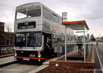 |
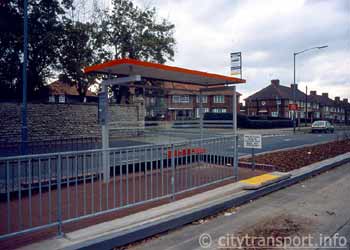 |
||
| A Tracline 65 bus at the Stockland Green bus stop. This was at the Birmingham end of the busway. |
Tracline 65 bus stop platforms were designed for single-door buses, requiring accurate stopping by bus drivers. The sign asks passengers to stand clear of the edge when a bus approaches, partly for safety but presumably also to allow alighting passengers to pass first. | ||
|
Promoted as Tracline 65, it featured a dedicated fleet of specially adapted brand new Mk2 Metrobuses. Because the guide wheel assemblies had the effect of making the vehicles wider than the legally permitted maximum width a special dispensation was obtained to allow these vehicles to be used on the public highway. To help make them more visible to other road users these assemblies were fitted with white reflectors on the front, red reflectors on the back and on the outer edge amber lights which were linked into the traffic direction indicators. Driver training was carried out at the test track at the Motor Industry Research Association (MIRA) where at a press demonstration it was shown that guided operation could actually be safer than 'normal' mode. For instance on emergency stops it would not matter if the front wheels locked as it was impossible for the bus to loose steering control; when bricks were placed on the track the bus shattered them and continued as if nothing had happened. This busway was only a small part of what effectively was an experiment in bus transport. The larger picture was to see if by a program of concentrated improvements along a specific route that led to faster journeys and a generally higher quality of service to passengers it would be possible to attract more people to bus transport. The guided section of Tracline 65 was just a 600 metre strip at the very end of the route in an area where traffic congestion was not an issue; elsewhere new bus lanes were created, parking restrictions introduced / stiffened, more and better bus shelters erected and there was much media publicity. As far as guided operation was concerned the experiment was always meant to be of limited duration and closure came in 1987 when following bus deregulation a rival bus company won the contract for the Sunday service and with it not willing to spend money equipping vehicles with guide wheels the situation arose whereby there would have had to be different stops (on the parallel dual carriageway) for different days of the week. Within the parameters set for it this experiment was proven successful. Bus patronage on route 65 rose by 29.3% compared to a more modest 4.2% within the West Midlands area as a whole. The guidance system proved both safe and reliable in operation, the initial fears that the protruding guide wheels might prove hazardous - especially to unwary pedestrians - were proven unfounded (although one did snap off when a bus that had been diverted away from its normal routing hit a kerb) and although little now remains of the Birmingham installation much valuable information was gained. |
|||
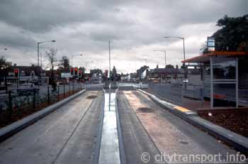 |
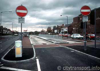 |
||
| Traffic signal controlled entry / exit point and the Stockland Green bus stop. Note 'dripping oil' deposits where the motor buses halt at traffic signals / bus stop. |
The same location as left but looking in the opposite direction. | ||
 |
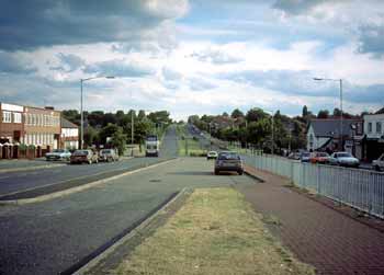 |
||
| The entry point at the Short Heath end of the busway. Note the bus stop, the Tracline 65 information board and one of the many saplings planted along the route. | Approximately the same viewpoint as left but seen in 1997 - when the busway had been (almost) completely removed and partially converted to extra car parking space. | ||
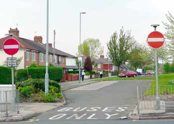 |
At Short Heath the busway ended at a traffic signalled junction after which the buses used a private (driver steered) road protected by normal "no entry" road signs and a qualifying plate which read Except Guided Buses on the pole.
-------------------------------------------- This view was taken in May 2008 - more than twenty years since closure - and the pole on the left still has the sign. This is (probably) the only feature of the busway that is still extant. |
||
|
Clicking any of these Tracline 65 images will lead to a dedicated page showing more (and larger) images in a popup window
alternatively clicking here will open the page in a new full-size window.
Kesgrave - The First 'Serious' British InstallationOpening in January 1995 this 200 metre installation is in Kesgrave, which is a village to the east of the city of Ipswich, in Suffolk. On one side is a small 'neighbourhood' sized branch of the Tesco supermarket chain (with car park); opposite is the local village hall / community centre while a combined pedestrian walkway and cycle path extends alongside the whole installation. (Kesgrave is noted for having excellent walking and cycling facilities, and with more than ⅔rds of its children taking advantage of these safe routes when travelling to / from school, few of them are overweight). |
|||
 |
 |
||
| A summer 1996 view looking along the busway from the Ipswich end. Being only 200 metres in length it takes just a few minutes to walk its entire length. To the left can be seen empty fields and a roadsign showing the 2.4m width restriction (the latter being more easily seen in the clickable larger version of this image). |
A summer 2006 view, showing the busway after it had been widened for standard width buses (2.55m) and landscaped. Note the sign showing the 2.6m width restriction. | ||
|
In an effort to deter all except the most foolish attempts at illegal entry steel channel galvanised traps are fitted at each end of both carriageways, whilst to enhance the visual impact the area has been landscaped. One unique feature of this busway is that it was designed for 'narrow gauge' buses 2.4 metres wide, so it is inaccessible to standard buses which will be either 2.5m or 2.55m wide. Services are provided by just one route (branded as Superoute 66) which was specially introduced by the Eastern Counties Omnibus Ltd. in partnership with the Suffolk County Council. It is part of the Ipswich Transport Strategy and is another UK demonstration project planned as the result of the national 'Buses Mean Business' campaign (of 1991) by the then 'Bus and Coach Council'. (Since the reintroduction of trams into British cities this organisation has been renamed as 'The Confederation of Passenger Transport'). 'Superoute 66' is registered as a commercial service, in theory bus deregulation means that another bus company could decide to operate a competing service over any (or all) of it - however as yet this has not happened. Also included in the new service were shelters for 80 of the other bus stops along the route, new bus lanes and the fitting of transponders to the buses so they can trigger traffic signals to change in their favour. There was also much publicity in the local media and most households within the catchment area received colourful easy-to-read timetables. A novel feature of this service is the use of Global Positioning Satellite technology for the 'real-time' information displays which are located at many of the bus stops, inside the Tesco store at Kesgrave, and in the buses themselves (to let passengers know the name of the next stop). 'Real-time' information is also available on the internet. |
|||
 |
 |
||
| A view of the 'Martlesham' end with two buses passing, and Tesco supermarket. When the line first opened it used high floor British-built Dennis Darts with Plaxton Pointer bodies. |
A winter view, showing the pedestrian crossing next to the bus stops, the bus stops / shelters, plus the pedestrian walkway and cycle track which
flank the busway (on the left) but in this weather were too slippery to use!
Heavy snow can also be a hazard for guided buses, as the buses will pack it under their wheels and if enough accumulates this could lead to the bus rising above the raised kerbs and 'derailing'. |
||
|
This service has been very successful - by October 1996 it was celebrating its millionth passenger journey. However this success is not because it included a section of guided busway, rather it is because it was treated as a 'quality product' involving the introduction of a package of integrated measures that were designed to meet the needs of its customers and were 'soId' with all the vigour of a supermarket with a fantastic new product that it wants everybody to purchase. That the product being 'sold' is passenger transport is just 'coincidental'. (This comment conforms with the philosophy behind many years of British Government Public Transport 'Policies'). Local reaction to the new service has been very mixed. Certainly the bus drivers are happy to be part of a success story - it meant their jobs are more secure! However, most local people are decidedly unimpressed, in fact the language used is not printable - with most questioning the 'need' for a 'showpiece' suggesting that if there is 'money to fritter' then it should be redirected towards the local hospital / school / old persons' home (etc). Some also questioned the need for 24-hour bus lanes on roads - elsewhere in the city - that only suffer congestion for short times in the rush hours. Especially for a bus route that does not provide a 24-hour service. Others complained about slower than necessary journeys because the anti-car Suffolk County Council is enthusiastically reducing speed limits on most of its roads. (The Speed page includes some information about previously safe roads in Suffolk that started having fatal accidents after the speed limits were reduced). The basic problem is that no-one understands the need for using guided bus technology, particularly in a new area where there was plenty of space for an ordinary 'driver steered' roadway that could have been restricted to 'buses only' in the usual way. The official reasoning behind the 'Superoute 66' project was that the County Council wanted a direct link between the expanding commercial and residential areas of Kesgrave and Martlesham Heath with Ipswich City Centre and Railway Station. The reason why any sort of private bus-only roadway was required is that it allows the buses to travel between two housing areas without following a circuitous route which would also include using a busy section of road and two delay-prone junctions, so that by using kerb guidance (and not an ordinary bus-only road) it was possible to be doubly sure that other vehicles would not be able to take advantage of this congestion-free shortcut. Apparently the original plans for 'Superoute 66' had included a second section of guided busway (through a butterfly meadow) but vociferous local campaigning forced its cancellation; however, on one of several visits to Kesgrave I discovered that being among the first to have something that others would also like to have does confer a certain kudos among your contemporaries. Put simply, I chanced upon a party of visiting dignitaries, with someone very proudly 'showing off' how the guidance system works, the raised kerbs, the landscaping, the real-time information system.... More information on the need for this busway plus a map showing its location relative to other roads in the area can be found on this page
http://www.buspriority.org/bus_gates.htm |
|||
 |
 |
||
More views showing the pedestrian crossing. Note the gap in the guideway, the red/white diagonal hazard striping to discourage
people from walking into the raised kerb and how the child cyclists are able to ride happily across the busway's 'track'. In the distance (in the image on the left) can be seen the
Tesco supermarket and car park.
2006 Information UpdateAs previously mentioned the Kesgrave guided busway was designed for buses 2.4m in width. However the success of this service has resulted in the need for larger buses and the busway has now been regauged for standard sized buses. Initially these were single deck Scania L94UB with Wright Axcess Floline bodywork, but by 2005 patronage had increased so much that these were replaced with 20 double deck Volvo B7TL with Alexander ALX400 bodywork. Appalling Service, Disgruntled LocalsIn September 2006 a visit was made to update this website photographically. Arrival in the Kesgrave area was approximately just before 1pm, and the visit was scheduled to be for about an hour. It was found that buses were timetabled to run at 15 minute intervals Monday - Saturday daytime, 30 minute intervals in the evenings and on Sundays, plus approximately 60 minute intervals at night. This compared slightly less favourably with the situation found on previous visits, when there was an enhanced 10 minute interval service during the afternoon busy period (3-7pm). However the larger buses can carry more passengers so total passenger capacity is still significantly enhanced. (The less frequent service should be more attractive to the bus company, whose operating costs - fewer buses & drivers - will be lower). On this visit some buses were found to be running exactly to time, which is commendable. However, others did not show up at all! For instance, the 13.12 to Ipswich failed to turn up, whilst the 13.27 arrived several minutes late. From their actions it could be deduced that the large crowd of people waiting at the bus stop were obviously wise to the workings of the bus 'service' because they suddenly started walking / running to the next bus stop (beyond the guideway), with those who are slower on their feet asking the quicker friends to hold the bus at the next stop whilst they caught up! From a hurried conversation with some of the running and out-of-breath would be passengers it was learnt that the next bus was only a single decker, which suggests that a vehicle that does not have guide wheels had been rostered for this service. Unfortunately this seems to not be an isolated incident. It was decided to wait for the 13.57 before leaving the area, however when this service was due it suddenly disappeared from the dot matrix screens and the 14.12 became the next scheduled service. With more than sufficient photographs (to update this page) having already been sourced plus there being another destination yet to be visited so it was decided that there would be little benefit in waiting to determine the fate of the 14.12. Before leaving however, a brief conversation with the 'very unhappy' crowd of people at the bus stop who had effectively been left in the lurch suggested that this is in no way untypical of the 'service'. Unfortunately most of their comments are unprintable, but as a general theme it can be deduced that if this is how a high profile service operating under a quality partnership system treats its passengers then it is no wonder that so many British people avoid public transport - of any kind. |
|||
 |
 |
||
| A double decker calls at the landscaped bus stop. | To deter private cars from entering steel channel galvanised traps are located at each end of both guided bus lanes. | ||
The Kerb Guided Busway County Of West YorkshireLeeds (Phase One)The first section of kerb guided busway in Leeds opened in September 1995. However, all that opened was the first section of the first of two separate schemes. This first scheme involves a total of 1.15km (approx ¾ mile) of guideway along the A61 'Scott Hall Road' which heads north towards Harrogate; the second scheme is expected to see a total of 4km (2½ miles) of guideway along the A64 York Road which heads east, towards York. Both schemes have been 'adopted' by the British Department of Transport as the 'Official UK Guided Bus Experiment', and are being built on an 'incremental' basis, as funds become available. As in Birmingham and Ipswich the sections of guided busway are technically parts of the public highway that are subject to 'guided buses only' restrictions. The significance of this for Leeds is that the installation works are being treated as general highway improvement schemes within the overall strategy for the area, and maintenance - should it become necessary - will also be the financial responsibility of the local highway authority and not the bus operators. Incidentally, there are also plans to reintroduce trams into Leeds, and the proposals include Scott Hall Road hosting one of the tram routes. However the British government's anti-tram bias (as demonstrated by its actions, not words) means that it is very unlikely that the same investment criteria will apply to the trams as the guided buses. And unlike bus companies, tram companies have to pay for the maintenance of their fixed infrastructure themselves. In Leeds the guided busway is seen as a 'congestion buster'. Short sections of single direction trackage are located at the approaches to roundabouts with transponders influencing traffic signals to make sure the bus side-steps any congestion. Unlike Ipswich the trackage consists of a reinforced concrete roadway and separate extra deep kerbstones acting as walls for the buses' guide-wheels. The system includes a long unguided inbound contra-flow bus lane which opened in December 1996 and is designed to help in the morning peaks. So far only local bus services feature guided operation, all of them follow the same corridor from Leeds City Centre and then in the suburbs fan out to serve various localities. Initially services were provided by a dedicated fleet of Scania N113 buses fitted with Alexander bodywork. They were purchased in 1994 as part of a larger fleet and are not low-floor, this is because at the time 'mainstream' low floor buses were not available, although they are now. (The first low-floor vehicle arrived in April 1997, and was used to open the third section of this busway). They are painted in a special 'Superbus' livery and because the idea is to create an up-market sophisticated image are finished to a high specification, including (information quoted from a timetable booklet) a clean, efficient engine, low emissions and a lower noise level; self-levelling air suspension for a smooth ride; efficient heaters for passenger comfort; high quality moquette seats for increased comfort. To make sure that passengers are properly welcomed aboard the bus drivers have undergone special 'customer care' training, for different reasons this training also included the special requirements of a guide-wheel equipped vehicle, including the importance of not hitting the kerb with the guide-wheels and how to use the busway. Because of the special driving techniques required the British government has made it a criminal offence for untrained drivers to drive guide-wheel equipped buses, whether on the busway or ordinary road. In the longer term there is an interest in using articulated buses, which being relatively rare in Britain would have a certain 'novelty' image. However they are more expensive to purchase, and at present the priority is to keep frequencies as high as possible. (Privatised bus companies have to make their choice of vehicles on stringent financial criteria). In pursuance of this aim summer 1997 saw an arctic being loaned from the Grampian Regional Transport fleet. This vehicle was an Alexander-bodied Mercedes-Benz 0405G, with the personalised plate of K1 GRT. Local reaction to the services has been very favourable. Within six weeks of the opening of the guideway bus usage had risen by 9%. Growth continued, and by May 1997 it had risen by a claimed 40% above patronage before the Superbus scheme commenced. Even a fares increase (on all services provided by the Yorkshire Rider Company) did little to slow the increase in patronage. However, as Dr Tebb (the UK's foremost promoter of kerb guided buses) pointed out, this success is primarily the result of a policy of 'whole corridor enhancement'; guided operation may make the journey a little faster, but equally important is the rest of the 'package', including the special livery, quality vehicle interiors, customer care training for drivers, household distribution of timetables and information, positive media profile, etc. In many ways success in Leeds only reinforces experiences gained in Birmingham and Ipswich. Speaking to local people there was plenty of enthusiasm for the improvements, but also a certain amount of dismay at the constant vandalism of the enclosed bus shelters. Apparently, the night before the official opening one bus shelter was given a police guard - to ensure all its glass was still intact the next morning! Other comments included that riding the guided section was no different to anywhere else and locating the bus stops in the guideway improves road safety (some years ago this lady saw a car crash into a bus whilst stationary at a stop which, because there was not a 'pull-in' was located in the normal carriageway). The above was (mostly) written in 1996. According to a study by the Transport Research Laboratory conducted in 1999, the private trackage results in buses now saving up to two minutes per journey with variability in journey times down by 75%. Furthermore, despite the need to keep calling at bus stops the ability to side-step traffic congestion make some rush hours bus journeys faster than cars. These factors, together with some other improvements (more direct routes, better vehicles, etc.,) have seen patronage rise by 6%. Surprisingly, other traffic has also benefited by almost 50 second reductions in journey durations - this is assumed to be because buses waiting at bus stops no longer block traffic lanes. According to the Leeds City Council website "the 450 metres of outbound guideway saves up to 3 minutes per bus in the afternoon peak and the 800 metres of inbound guideway saves up to 5 minutes per bus in the morning peak. All sections create absolute consistency in bus running times peak and off-peak, thereby enhancing service regularity and punctuality. The final phase of 400m of guideway opened in July 1998 and this too has achieved timesaving benefits." In addition to just installing guided busways, the bus stops on the guided section were upgraded to light rail standard, featuring level boarding, tactile paving and good quality shelters whilst away from the guideway a form of 'bus docking' was introduced which uses the guide wheel arrangement to allow buses to pull up close to the kerb, facilitating level access for passengers with mobility problems. Also included is automatic vehicle detection equipment which gives buses priority as they approach signalled junctions. |
|||
 |
 |
||
| From the days of Leeds City Buses comes this image of a demonstration kerb guided bus on a non-passenger test track. Image courtesy of Dr Tebb. |
One of the original Leeds kerb guided Superbus vehicles calling at a kerb guided bus stop on Scott Hall Road. | ||
 |
 |
||
| Busway sign at the entrance to the first part of the Scott Hall Road section of busway. This image has been heavily cropped and the clickable larger version shows more of the bus. | The Scott Hall Road kerb guided busway includes a section of busway located in the median strip of the dual carriageway. Seen here under construction, in 1997. | ||
| The two images above were taken using a 'stretch' / 'panoramic' camera, which explains their different format.
The five images below date from July 2012 and were taken at about 5.45pm / 17:45 in what was expected to have been the evening peak hour traffic. The idea was to see buses sidestepping long queues of traffic, but the roads were almost empty. |
|||
 |
 |
||
| North Leeds: A section of kerb guided busway located between the footpath and the roadway along the Scott Hall Road. | Pedestrian crossing point complete with 'tactile' paving (to help blind people) on the same section of kerb guided busway | ||
 |
Entry to a section of Scott Hall Road kerb guided busway which is located in the median strip of the dual carriageway. The bus seen here is about to arrive at the Steinbeck Lane guided busway bus stop. The buses seen in these 2012 images are FirstGroup diesel-electric hybrids with 10.4 metres Volvo B5L chassis and Wright Eclipse Gemini 2 bodywork. BP11 JWE is fleet No. 39224. |
||
 |
 |
||
| Calling at the Steinbeck Lane guided busway bus stop. | The same bus a few moments later as it travels along the kerb guided busway. | ||
More In West YorkshireOn 5th November 2001 the second tranche of guided busway opened in Leeds. Marketed under the name of 'elite' and costing about £16 million it features a total of 2.1km (1 ⅓rd mile) of guided busway plus 2.6km (1 ⅔rds miles) of new (unguided) bus lanes on York Road and Selby Road in East Leeds. For this scheme over 330 bus stops have been reconstructed and 150 shelters replaced, plus all stops raised to 160mm at the kerb to allow easier access on to the dedicated fleet of low-floor easy access buses. The new shelters are modern in design, with internal lighting and a large area of 'transparency' so that waiting passengers can see all around them as well as being seen by others. The roof is also transparent to allow in more daylight. The shelters also feature improved information displays, which are larger and easier to read. As part of the high-profile publicity scheme all new shelters are red and cream in colour and can also be identified by their purple "half-moon" ends and purple timetable cases. The intention is that if passengers see a bus shelter featuring the elite scheme's purple, they can have confidence that it will be served by the new 'elite' buses. In due course it is intended to introduce a 'real time information' system using global positioning satellite technology. This scheme is also innovative because two competing bus operators (First and ARRIVA Yorkshire) are involved; between them they have invested heavily (£6 million!) in a total of over 40 new 78-seater double-decker buses, enabling passengers to travel in style and comfort. However there are some other bus companies which also provide services over these sections of road and when elite opened they neither invested in new vehicles, nor equipped their existing buses with guide-wheels - which means that they cannot use the new guided busway. This means that in places there are two sets of bus stops for buses travelling in the same direction - one each on and off the guideway. It remains to be seen whether they find it commercially desirable to fit guide-wheels to their buses. |
|||
 |
 |
||
| A general view (from a convenient footbridge) showing a section of the East Leeds elite guided busway where guidance is for outbound buses. Note the bus stop for non-guided buses (right) and continuous inbound unguided bus lane (left). | From the same footbridge a view of a busy double road intersection showing a short unguided section and around which cross traffic can wait for their turn at the traffic signals. | ||
 |
 |
||
| Beyond the junction with the Selby Road York Road features a short section of two-way guided busway, complete with bus stops both on and off the busway. The 20mph (30km/h) speed limit is primarily aimed at buses which pass through the guided bus stop without stopping. Whilst the idea is to improve safety it also gives the impression that tracked buses are slow buses - especially at times when traffic congestion is not an issue. | Selby Road features a short inbound busway which ends just before the road narrows to pass under a railway bridge. | ||
 |
 |
||
| The deregulated free-for-all cut throat competition which represents how most British bus services are operated creates the situation where rival bus operators are allowed to use buses
not equipped with guidewheels on services that compete with the guided buses... these buses continue to use the public highway and call at normal kerbside bus stops.
This also means that many bus stops must be duplicated, creating confusion for passengers who just want the first bus, irrespective of operator. |
Traffic signals with visually distinctive twin converging white lines instead of a green lamp help prevent other road users confusing their signals with those dedicated to the buses. | ||
|
Hot on the heels of the opening of Leeds's second guided busway another Yorkshire city has opened its first installation. This was on the 31st January 2002 and is in nearby Bradford. Here there are five sections totalling 2.3km (1½) of guided busway which form part of a 3.7km (2¼ miles) Quality Bus Initiative along the A641 Manchester Road. This installation includes 11 new traffic light-controlled pedestrian crossings, new footpaths, seats, plus major landscaping which has seen the planting of thousands of bulbs and shrubs and scores of trees. Perversely the opening of the Bradford guided busway was accompanied by a 25% reduction in the parallel road's speed limit (from 40mph to 30mph [65km/h - 50km/h]). Unfortunately this creates the impression that faster, better & generally more attractive bus transports can only be achieved if car travel is made slower and less attractive. This lunacy suggests that the transport planners have fallen prey to the Luddite anti-car ideology of "lets screw the motorist in every which way we can" instead of following what is the only true solution to traffic congestion - this being improving the public transports in their own right so that those people who have a choice (ie: car users!) will see them to provide positive alternative choices to driving. |
|||
 |
 |
||
| Both Leeds and Bradford feature low-floor easy access single and double deck buses on their busways. | Bradford's busway has several of these 'super stops' which feature wind turbine powered electrically heated seats! | ||
 |
 |
||
| In theory traffic signal pre-emption will help the buses get past the signals with a minimum of delay - however it can go wrong as happened here when three buses arrived simultaneously and the third one became trapped behind red signals. However the service is so frequent that within a matter of minutes the next bus arrived and this bus too was on its way. Ironically this bus was on an express service - so was not scheduled to call at the bus stop from where this photo was taken! | Traffic signals allow cars turning right to cross the path of a road-centre guided busway in safety.
Note the "safety" railings along the side of the busway - apparently because they disbenefit pedestrians by preventing them from crossing the roads at locations convenient to them so some pedestrians have resorted to climbing over the railings. Unfortunately on several occasions serious accidents have ensued where pedestrians ended up in the path of the buses, which of course cannot steer to avoid them. Maybe safety would be enhanced if the busways were left unfenced? |
||
Even More In England - And (For A While) Some In Scotland Too!In September 2003 the first stage of the planned 24km (16¾ mile) Sussex "Fastway" scheme opened. At first information sources suggested that when complete this system would feature 2.5km (2 miles) of guided busway plus 9km (just over 5½ miles) of ordinary busway on services linking Gatwick Airport with the nearby towns of Crawley and Horley. However, in the event this became 1.5km (a little under 1 mile) of guided busway and 5.8km (3.6 miles) of normal busway. This is the first use of kerb guidance as part of a regional transport system which serves multiple towns (and multiple counties) rather than just one major city and its suburbs. Construction began in May 2002, and was scheduled to be completed by 'early 2005' - although timetables slipped with construction works being halted in October 2006. Bus rapid transit was chosen...
The projected cost started at £27 million and was later revised to £32 million, then £35 million. Even before construction works were halted with just 60% of the planned system completed it was reported that there had been an overspend of at least £6 million. However, overspends are not unusual for large scale roadway schemes. |
|||
The Fastway project is promoted and funded by a Public-Private Partnership. The consortium includes West Sussex County Council, Surrey County Council, Crawley Borough Council, Reigate and Banstead
Borough Council, BAA (British Airports Authority) Gatwick, British Airways, Metrobus and the Go-Ahead Group. |

A Fastway guided bus on Southgate Avenue, Crawley. Image & license: Radamfi / Wikipedia encyclopædia. Free Use. http://commons.wikimedia.org/wiki/File:Metrobus_540_ YN03_WRP_and_Crawley_Southgate_Avenue_guided_busway.JPG. |
||
|
Since Fastway first opened Metrobus, the bus operator, has stated that passenger figures are up 10%, with 35% of all journeys being to and from the airport at Gatwick. On average it is carrying 7000 passengers a day, with one million passengers having been carried in the first seven months of operation. It has also indicated that delays have been reduced by the new bus lanes and bus gate. Initially two bus routes operated under the Fastway banner, these being Nos. 10 and 20. In some areas the two services overlap, providing combined services.
Initially Fastway used 2.55m wide (for the 2.6m guideway) 10.9m Scania Omnicity buses painted in a striking silver and blue livery (so they are easy to spot!) which were selected by bus operator Metrobus following consultation with potential users including commuters, schoolchildren and passengers with special needs. Route 10 had a peak vehicle requirement of 9 buses, whilst route 20 required 5 buses, leaving three spare. For operational convenience the buses are 'pooled' between the routes, so they can work on either of them. Although specially branded in Fastway livery in the occasional event of no other buses being available they will be used on other services too. The addition of route 100 to the Fastway network saw a further ten of these specially branded buses which feature part-leather seating being added to the fleet. By the end of 2010 the Fastway fleet comprised a mix of
specially branded Scania Omnicity B37D bodied buses on Scania CN94UB or Scania CN230UB chassis and Scania Omnicity B33F bodied buses on Scania CN230UB chassis. As this page is primarily about bus guidance and not the buses themselves
it is not intended to record vehicles changes as they occur during future years. However interested readers can find this information on the bus operator‘s website at
http://www.metrobus.co.uk/fleet.php Fastway uses a modern real-time passenger information (RTPI) system developed and installed by public transport provider ACIS. Using satellite-based Global Positioning System (GPS) and Automated Vehicle Location (AVL) technology, the control centre tracks the exact position of each vehicle in service and monitors its movements, using the information to react promptly to any disruptions and so maintain schedules. The Sussex "Fastway" Bus Priority scheme uses bus guidance for "congestion busting", for instance to get past queues on the approach to roundabouts and traffic signalled junctions, as seen here.
(Many road users would suggest that too frequently the traffic signals are the primary cause of the congestion the guideway has been installed to by-pass). |
|||
 |
 |
||
| These images show one of the system‘s shorter lengths of guided busway - at the time of taking them (spring 2004) much of the system was still to open. | |||
 |
 |
||
| Another 2004 view showing one of Fastway‘s congestion busting sections of kerbside guided busway on the approach to a roundabout. | One of the later sections to open included this section of guided busway located in the median of a dual carriageway. By being track guided it is possible for this bus-only right of to be much narrower than would have been required for a normal driver-steered 'buses only' traffic lane. | ||
The section of road-centre busway seen above - right ends at a roundabout where the buses have been provided with a special lane which allows them to travel straight across the central circle. This is seen below |
|||
 |
 |
||
| A kerb guided bus approaches the roundabout and its dedicated traffic lane through the middle. | Emerging on the other side of the roundabout. This bus is Metrobus 578 (YT09 BKV) a Scania OmniCity.
Image & license: Arriva 436 / Wikipedia encyclopædia. CC BY-SA 3.0 http://commons.wikimedia.org/wiki/File:Metrobus_578_YT09_BKV.JPG. |
||
 |
 |
||
Most sections of guided busway are strictly reserved for guided buses, and this is enforced with a 'no entry' road sign plus a qualifying plate which exempts guided buses (as seen above left),
however the guided busway at the traffic roundabout seen above right is protected by normal bus lane signage with the word 'guided' added to the bus pictogram and a cycle image as well. This means that this guided busway can also be used by cyclists.
Adverse CommentsThere can be no doubt that many people have benefitted from the introduction of Fastway. But there has also been much hostile criticism, especially by people who feel that it is not providing value for money and people who feel that the new services do not meet their needs (a comment which implies that there is a need for additional Fastway routes). Of course it must be remembered that generally only people who are not happy will make comments. Happy people are usually too busy to register their satisfaction! An independent inquiry into why the construction was £6m over budget and nearly two years behind schedule found that the cost overrun was mainly due to an increase in construction costs due to high inflation in the industry and major delays to work that needed to be done by utility companies. The overspend is being met by West Sussex council tax payers. At one stage a petition was launched for the restoration of double-deck buses on several routes (including Fastway No.10) which serve Crawley. This was because of peak hour overcrowding and passengers being left behind. Below are some gripes which in June 2006 were found on this page http://en.wikipedia.org/wiki/Talk:Crawley_Fastway The project has required the destruction of large sections of the existing road infrastructure.
The West Edinburgh Busways (WEBS) "Fastlink" Busway5th December 2004 saw the opening of the West Edinburgh Busways (WEBS) "Fastlink" busway scheme. Comprising of 1.5km (just under 1 mile) of two-lane dedicated kerb guided busway, this was the first kerb guided busway in Scotland and at the time it featured the longest section of continuous guideway in the UK. Also featuring 3.45km (a little under 2¼ miles) of on-street bus lanes this £10m scheme also included CCTV surveillance, other bus priority measures, upgrades to existing bus stops and road widening to accommodate one of the new bus lanes. Fastlink was located on an 8km (5 mile) bus corridor which stretched from Edinburgh city centre to Edinburgh Park. One of the primary motivating factors in the construction of Fastlink was that it would allow buses to 'congestion bust' by bypassing queues on the approaches to two major roundabouts between Edinburgh Park and the city centre. The guided section of Fastlink featured four bus halts; elsewhere along the system some bus stops were improved to allow buses to pull-in closer to the kerb. This was done so as to permit easier boarding and alighting for all passengers, especially those with mobility difficulties and those with pushchairs. A number of existing bus shelters along the Fastlink corridor were also upgraded. Together with the guideway and bus lanes, parking and loading restrictions were introduced to improve the overall performance of Fastlink and to ensure that passengers get maximum benefit. 30 new buses were bought by Lothian Buses at a cost of £4m, which along with 20 existing buses provided a dedicated service for Fastlink. Each of these buses was fitted with rubber wheeled guide-arms that allowed them to travel along the guideway section. These guide arms (which did not retract) extended to a maximum of 75mm (3") from the side of buses. Two bus routes used the Fastlink guided busway - Lothian Service routes 2 (using double deck buses) and 22 (using single deck buses). In its early days there were numerous public complaints about the poor quality of ride whilst travelling along the kerb guided busway. As a result there were two temporary closures in July and September 2005 for remedial works on the guideway. When it was built the Fastlink guided busway was designed and constructed for future conversion to tram operation. Therefore it was always intended that this was only be a short-lived kerb guided busway, so with tramway works advancing January 2009 saw its closure for conversion to tramway. |
|||
 |
 |
||
| A bus on route 22 heading towards Edinburgh City Centre passes the special road sign as it joins the busway. | To help avoid traffic congestion a design feature of the guided busway was for it to use high-level bridges (such as seen behind the bus) to by-pass several roundabouts. | ||
 |
 |
||
| This busway had a rather low maximum speed limit of just 30 mph (50km/h), which was probably just as well as when visited in May 2005 it was found that the buses seemed to "hunt" (or wriggle from side-to-side) somewhat more than
on some other kerb guided busways. From a closer inspection of the inside face of the busway trackage (whilst waiting at the Broomhouse Halt East bus stop) it was noted that the trackage had (probably) been formed from concrete which was cast on-site, and that there were what looked like slight corrugations on the inside faces of the raised kerbs - these being the surfaces which the guide-wheels use to steer the buses. |
A traffic signalled pedestrian crossing at a guided bus stop. Both double and single deck buses served this guided busway. The 20 mph (30km/h) speed limit applied whilst passing the bus stop - and was primarily
aimed at buses which were passing through without stopping.
Image & license: Richard Webb / Geograph Project. CC BY-SA 2.0 http://www.geograph.org.uk/photo/16352. |
||
Any More For Great Britain? |
|||
 |
A typical scene in Britain (as seen from an upstairs front window on a double deck bus) - a dual carriageway in sore need of bus priority measures.
'Ordinary' bus lanes would not be appropriate here whereas kerb guidance would provide an optimum congestion-busting solution that would not be open to abuse from other road vehicles. |
||
As the image above suggests, there are many other locations which would also benefit from this technology. Yet even though the government claims to be very supportive of bus transport very little is actually coming into fruition. In many ways this lack of progress mirrors the paucity of 'new build' investments in all of Britain‘s other public transports - is this because in reality the politicians (and civil servants) just don't care? (surely not?!) -- -- or do they
see no point because of some future event(s) which will make such investments pointless?? [Former] Prime Minister Tony Blair is well known for talking about meteor strikes / near misses on planet earth, other sources talk of rising sea levels
causing significant flooding whilst some 'alternative' sources suggest that frantic efforts are underway to build several thousand "Noah‘s Ark" - style deep underground basis to allow a portion of humankind to survive some imminent catastrophe(s);
then there is the Svalbard Global Seed Vault -----------------------------------------------------------------------------------------
Whilst bus rapid transit (BRT) systems are being installed in many countries planetwide Britain seems to be the only country which sees kerb guided busway technology as useful part of BRT / other bus services. Over the years many transport planners, private bus companies and local governments have investigated such schemes for their areas, although (as with proposed tramway systems) issues related to financing their construction have seen most fall by the wayside. Virtually all of the proposed schemes include guidance as part of a wider package of 'overall corridor enhancements', which is very important, as it is not good enough to just bypass traffic queues - high quality buses and bus stops, real-time information, good road surfaces (and more) are also important aspects of successful transport whilst minimalistic bus stops with perhaps careworn shelters (if at all) and old tatty buses with poor internal fittings simply will not provide an attractive alternative to either a comfortable motor car or a rail journey. This explains why there is a constant concern among the 'quality bus' operators that if a 'cheepo' bus company was to equip its vehicles with guide wheels it would undermine their efforts to prove that bus transport can also be quality transport. In the cut-throat competitive world of bus deregulation there is little to prevent this from happening, except perhaps the ability of a company to afford the initial outlay. Out Of The Many - Just A Few More!In its spending plans for 2004/5 the government announced that £279.3million would be allocated to 11 major public transport projects (as a comparison remember that road users pay over £40billion per annum in taxes) including two more British guided busways - these being between Cambridge and Huntingdon (£65million) and between Luton and Dunstable (£78.4million). Granting of funding however was only a (significant) stepping stone - before construction could begin these proposals still needed to achieve planning permission and meet a multitude of other regulatory requirements. * The Cambridgeshire Guided Busway scheme involves 17 miles (27.3km) of two-way kerb guided busway which partially re-use a closed railway trackbed linking the University City of Cambridge with St Ives and Huntingdon. The plans included building several 500-car park + ride sites and to comply with the deregulated nature of British bus operations it was decided that the busway is to be open to all operators who are willing to enter into bus quality partnerships. (See below). * The Luton to Dunstable Busway. An 8 mile (13 km) two-way kerb guided busway taking over a closed rail line between Luton and Dunstable, Bedfordshire as well as conversion of a former freight-only rail line to Houghton Regis into a bus-only road. Some busway services will extend beyond Luton towards Luton Airport. At the time of funding it was expected that construction of this busway would commence in 2008, however this did not come to pass. (See below). * At a later date approval was also given to the Leigh-Salford-Manchester Bus Rapid Transit (BRT). This 4 1/3rd mile (7 km) guided busway is along the route of a closed railway and part of 25 miles (40 km) of bus lanes / bus priorities on several major transport corridors linking suburban communities with Manchester city centre. Alongside the kerb guided busway is a shared walkway / cycle lane / bridle way. Construction began in 2012 and it opened in April 2016. * It looks like the city of Bristol will (after many years of planning) actually be constructing a BRT network and that it really will include some kerb guided busway. It may be significant that these schemes include the conversion of railway to busway... as alternatives to reopening the railways, even to light rail. Govt. Approval & Funding For The Cambridgeshire Guided BuswayAt the end of June 2006 it was announced that the govt. had approved the Cambridgeshire Guided Busway scheme and agreed to provide a grant of £92.5m, with developers building homes which will be served by the buses being asked to contribute the balance of £23.7m. Since first proposed the cost of this scheme rose considerably - in 2002 it was estimated to cost £73m, which just 18 months later had rocketed up to £86m. The price tag at the time of its receiving government approval was an even more heavily inflated £116.2m, with general inflation and rising construction costs being cited for the significant upwards spiral. Once completed the total length of this BRT system will be 25 miles (40km) of which about 14.5 miles (23km) will be guided with the 10.5 miles (17km) balance being on normal roads. This will make this the longest kerb guided busway anywhere planetwide. The entire route will be in two sections linking St Ives to the north of Cambridge with Trumpington to the south of Cambridge, with buses travelling through Cambridge en route. Only the longer northern section will be suitable for double deck buses. Much of the guided busway will include a cycle track alongside it, this can also act as an emergency access in required. In the Trumpington area where the former double track railway passed through a cutting the guided busway will feature a short bi-directional single track section as this will leave space for the adjoining cycle / emergency track. Initially there will be three Park + Ride facilities - at St Ives, Longstanton and Trumpington. The contract to build the system was awarded to the same construction company that built the Sussex Fastway system, however to avoid the potential for cost overruns Cambridgeshire County Council entered into a contract which made the engineering firm primarily responsible for costs if the scheme runs over budget. It was decided that for the best possible quality of ride on what for many passengers will be journeys of over 20 minutes in duration the guided section should be formed of Essen-style pre-cast concrete beams. 12 metres in length these were manufactured locally in a specialist factory which was built for this purpose. Construction began in summer 2007, in the process endearing the system to local people in ways which even 'out-does' the installation of street-based tramway systems. In short, where the busway crosses roads (ie: at former railway level crossings) the roads were closed for typically three (3) but at some locations as long as four (4) months... Meanwhile rebuilding bridges to create sufficient headroom to allow double deck buses to pass under them resulted in even longer road closures - in some cases almost a year. These excessively long time periods could be said to not be the best way to make friends with the local communities. The level crossing closures were so that the concrete panels which form the road surface (minus the sidewalls, of course) could be laid on the crossings too, thereby ensuring that even at crossings the buses will benefit from the best possible road surface. The original intended completion date was April 2009. Initially four bus operators were set to run the services, however due to the very fluid nature of Britain‘s local bus industry this figure later changed. All bus operators are expected to use low floor accessible buses which offer high levels of passenger comfort. By March 2008 the first four miles of the guideway had been constructed and tests were underway with buses from various bus manufacturers prior to a preferred vehicle being selected. The buses involved in these trials were fitted with sensors to assess vibration levels and the ride quality, in order to find vehicles which would meet the expectation of allowing passengers to be able to read, or use laptop computers, during their journey. Once a decision had been made one bus operator spent £3m on a fleet of luxury 20 bio-diesel guided buses equipped with air-conditioning, leather seats and Wi-Fi. Although at the public inquiry before the busway was built it was said that all bus operators would enter into a joint fares and ticketing scheme, this has proven to not be the reality (as explained below), and instead bus tickets are not interchangeable between bus companies, so passengers who just want the first bus which arrives will find that their fares vary depending on which bus company own the bus. It is unfortunate that (as with all other British guided bus systems) this scheme is set to only be ‘second best’ environmentally. This is because whilst environmental friendliness is also a desired feature by opting for a motorbus system this is not possible. Compared to trolleybuses, which (like electric trains and trams) do not give off any tailpipe pollution so motor buses - which includes hybrid buses - can only ever be "less dirty", and never "clean". The planning stages of this project saw significant very vocal local opposition, mainly because it is re-using a former railway line which was closed by Dr Beeching in the 1960‘s. Many campaigners were suggesting that instead of its bustitution it should be reopened as part of a strategic east-west railway route which would be served by both local passenger trains and longer distance freight trains. It was also suggested that the route would have been ideal for track sharing with light rail services which (as in some towns in Germany) could have been extended beyond the mainline into the heart of Cambridge city centre. Some people also pointed out that the mere need for this route for "any" transport use helps justify claims that Dr Beeching‘s closures were wrong and should be reversed at many other locations around Britain too. (Claims which are very difficult to refute). Pro-bus campaigners point to the ability of the scheme to serve more areas with through services than any form of rail service could provide and are not concerned about suggestions that many of the advantages of the dedicated right of way that the busway provides will be lost once the buses leave the busway and hit the very congested streets of Cambridge. Although this will be the longest kerb guided busway 'anywhere on planet Earth' it will not be the fastest, as it has been designed for a cruising speed of 55mph (90km/h) which is about 7mph (10km/h) slower than the Adelaide system. For safety speeds at level crossings with the public highway (where there are short gaps in the guidewalls) are capped at 30mph (50km/h). As with all British busway schemes the track is 'owned' by the local government (in this case Cambridgeshire County Council). They have granted two bus companies exclusive use of the track between 7am and 7pm (07:00 and 19:00) for a five year period, and in exchange the bus companies have agreed to meet the specified minimum levels of service / minimum vehicle standards and pay a 'road user' fee for using the busway. Late Opening; Cost Overruns; Penalty Charges; Court Case Pending!Initially the first public service buses were expected to be in service (on the northern section of the busway, between St Ives and Cambridge) towards the end of 2008, but that then slipped to spring 2009, which then became autumn 2009, and then into 2010... The new buses however did enter service in the spring of 2009, albeit on other routes and without their guidewheels. According to local media reports the delay in opening is being attributed to weather-related delays in its construction and disputes between the County Council and the company building the guided busway‘s physical infrastructure related to cost overruns. In February 2010 media reports were suggesting that with the busway over a year behind schedule the company building it were being fined £14,000 a day for not having completed it in time, with the late-delivery penalty already having reached of more than £4.7million. One newspaper report included the following rather ominous phrase which speaks volumes... "The legal profession is licking its lips." Also in February, the sheer frustration of the delays saw one of the bus companies whose vehicles will serve the busway changing the advertising slogan painted on the sides of their vehicles from "I'll be on the busway soon, will you?" to "Will I be on the busway soon?". By April 2010 opening dates had stopped being set, instead it was just being advertised as "some unspecified time in 2010 or 2011". In addition the latest estimates were putting the cost of the scheme at about £161million. By December the estimated cost had skyrocketed even higher, to over £180million - this being very significantly higher than the £54million estimate when the scheme was first mooted! In June 2010 it was announced that the daily 'fine' for the system not being opened according to schedule had reached £6million. Additional information can be found at these links, which open in new windows |
|||

Image & license: Keith Edkins / Geograph Project. CC BY-SA 2.0 http://www.geograph.org.uk/photo/660526 |

Image & license: Kevin Steinhardt / Geograph Project. CC BY-SA 2.0 http://www.geograph.org.uk/photo/1695238 |
||
Two images showing the guided busway under construction and almost ready to open.
Left: The concrete track installed and ready for landscaping. Right: Regional College bus stop. Finally It OpensKerb guided bus services on what is being marketed as The Busway finally commenced on 7th August 2011. |
|||
 |
 |
||
| Go Whippet bus (reg. AE59 EHR) branded for and operating Cambridgeshire Guided Busway route C, on the first day of public services.
Image & license: Bob Castle / Wikipedia encyclopædia. CC BY-SA 3.0 http://commons.wikimedia.org/wiki/File:Guided_bus_opening_day2.jpg. |
Stagecoach in Huntingdonshire bus 15461 (reg. AE09 GYJ), branded for and operating on the Cambridgeshire Guided Busway, on the first day of public services.
Image & license: Bob Castle / Wikipedia encyclopædia. CC BY-SA 3.0 http://commons.wikimedia.org/wiki/File:Guided_bus_opening_day3.jpg. |
||
Two bus companies provide services in The Busway. Stagecoach operate routes A and B whilst Go Whippet operate routes C and D. Route A uses single deck buses and serves the entire busway. Route B uses double deck buses, which means that it can only use the section of busway north of Cambridge. Both routes operate every 15 minutes Monday - Saturday daytime. Route A also provides evening services, albeit hourly. Route B does not operate on Sundays. Routes C provides an hourly service Monday - Saturday and less frequent on Sundays. Route D is basically a variant of route C which deviates a little. However there are only a 2-3 journeys a day; its probably best to think of them as Monday - Friday 'rush hour extras'. Because of the 'outer-suburban' nature of busway services it is strongly suggested that prospective visitors study the timetables if travelling during the evenings and at weekends. When calling at bus stops on the guided busway passengers must use the ticket machines to pay their fares. Elsewhere it is possible to pay the driver on boarding. Fares Integration FudgeIn typical British fashion the two bus companies providing services on The Busway sell their own single, day and weekly tickets which are priced differently and can only be used on their own services. At least in part this is because otherwise they will risk the Governments' Office of Fair Trading crying foul / claiming that a big business cartel which is against the public‘s best interests might be being formed. In an attempt to remedy this insane situation Cambridgeshire County Council has introduced a prepaid smartcard ticket which can be used on either bus operator‘s vehicles and for some journeys also allows free interchange from one bus to another - again, irrespective of bus operator. Smartcards are sold with 10 single rides preloaded on them, which must be used within two (2) months after purchase. After that the rides expire and their value is lost / not refundable. Bus drivers can reload the smartcards, again by selling blocks of 10 rides. It is permitted to share the smartcards with other family members or friends, however only one person can travel at a time (on the same bus) using a smartcard - this means that if travelling as a group each person will need their own smartcard. Lost smartcards are not refundable and therefore passengers are advised to look after them with the same diligence as used when looking after cash. Smartcard fares are based on a zonal system, with higher fares for travelling through more zones. There are five zones. One Millionth PassengerOn 12 January 2012 The Busway celebrated its one millionth passenger. In August 2012 Stagecoach increased services frequencies from 3 to 4 buses an hour. This reflects the increasing passenger numbers and that it is starting to become an understood and integral part of the region‘s public transport network. Another sign of the growing popularity of Busway services is that there are sometimes complaints about buses being overcrowded - especially during the school term. Court Case AvoidedThe court case between Cambridgeshire County Council and BAM Nuttal (who built the Busway) was scheduled to be held in January 2014 at the London Technology and Construction Court. As the first two linked articles (below) suggest, it was possible that if Cambridgeshire County Council had lost the court case then the total overall cost of the busway scheme could have ended up at £229.6 million! However, as the third and fourth links suggest, in August 2013 an out-of-court settlement was reached which halted all further legal actions - and also stopped the legal fees from rising any further. The two parties agreed that the council would pay BAM Nuttal £84.7 million, rather than the originally agreed £83.9 million. The fifth link talks about newspaper letters to the editor by unhappy readers which relate to the settlement, allegations of the public having been misled by the County Council and people being unhappy that the overrun of costs has become a burden on the local taxpayers. (Only basic facts about this disagreement are being reported here - your own web searches will probably find more detailed information) Additional information can be found at these links, which open in new windows Final Construction CostBecause of the legal and other charges incurred during the dispute the final cost of building the busway has ended up at £152 million, this being £36 million more than the £116.2 million expected cost when the project received government approval. Cars / Other Vehicles - On The Busway!There have been numerous instances of unauthorised vehicles trying to use the busway. Mostly in error, such as becoming confused and taking a wrong turning during the hours of darkness, or following a satellite navigation system which was malfunctioning. It is not intended to keep of a log of such events here. Operating Costs CoveredIn October 2013 it became known that the access charges being paid by the bus companies (Stagecoach and Whippet) were sufficient to cover the County Council‘s busway operating costs busway. The quoted amounts received were £349,572 in its first year of operations and £597,734 in its second year of operations. Data source (several news items in the one article) These next links are for the two campaigning websites which wanted a steel wheel transport solution (light / heavy rail) that would also see the route suitable for freight trains The Additional information can be found at these links More Frequency Increases To Cope With Passenger NumbersIn April 2014 it was announced that in an attempt to end severe overcrowding and passengers being unable to board full buses the rush hour service would be increased to a bus every five minutes. The increased services are needed for passengers travelling from St Ives towards Cambridge the morning rush hour and in reverse in the evening rush hour. The changes will also see more buses serving local communities which are near to the kerb guided busway. It is estimated that annual patronage has reached approximately 3 million passengers. Fresh Infrastructure WoesIn April 2014 a local newspaper reported that fresh faults have been found with every concrete beam which could cost £20 million to rectify. The most serious problem stated to be that many of the bearings which lie between the busway beams and their foundations have
moved out of place, causing the beam to drop and a step to appear in the track. In the worst affected locations as many as 70% of the beams are claimed to be involved with reduced speed limits having to be imposed and emergency remedial works carried out at night. Some faults
are cited to possibly be related to the high water table, drainage issues, and that the foundations are on clay which shrinks during drought and swells in wet periods. More information can be found in this link:.
Usage Still RisingThe numbers of passengers using the system continues to increase, with (by summer 2015) the system carrying over 300,000 passengers a month. This is despite the imposition of parking charges at the park & ride car parks which resulted in a 14% drop in the number of cars using the car parks. Unguided Expansion With Bus GatesIn 2016 a 600m new route is expected to open linking Milton Road with Cambridge Science Park station. This link will comprise a normal unguided busway (ie: what looks like a normal road) however to ensure that only kerb guided buses can use it there will be short sections of kerb guided busway at each end. Effectively these will act like what are known as bus gates. Govt. Approval & Funding For The Luton - Dunstable Kerb Guided BuswayIn September 2008 the very contentious proposals to convert the former railway between Houghton Regis, Dunstable and Luton to a guided busway received a green light from the government. This busway is jointly promoted by Luton Borough Council and Bedfordshire County Council who believe that a busway is the most cost-effective option for improving public transport in the area. At the time it was expected to cost £85m, with the government providing a grant of £78m - albeit on the provision that the balance is secured through additional investment. Prior to its approval there was significant lobbying to retain the alignment for heavy or light rail use. Many people wanted the Luton - Dunstable line to be re-opened with the north-south cross-London "Thameslink" trains extended over it and for it to be available for freight trains too; however the railway industry did not want the line with its fate being sealed in a visit to Luton in November 2003 when Richard Bowker, the (then) Chairman & Chief Executive of the Strategic Rail Authority categorically stated that there was "no chance of the line being re-opened for rail passengers." At one time this guided busway was expected to open in 2011, but as by spring 2010 construction had not even began so obviously this was not a realistic proposition. In March 2010 the government gave what was said to be the 'final' approval for this scheme. Coming just a few months before a general election the timing could be said to have as much to do with politics and wanting to be re-elected as improved public transport. The grant was also confirmed at £80.2million. At the start of June 2010 Luton Borough Council hosted a groundbreaking ‘start of works’ ceremony for what was now being described as the £89million Luton - Dunstable Busway. Since then construction progressed rapidly, with a projected opening timeframe of spring 2013. In autumn 2012 Arriva (bus company) took delivery of 11 Wright Eclipse 2 bodied Volvo B7RLE buses for its busway services. Valued at £1.7million these are initially being used on a service that is routed via the public highway. Because they also serve Luton Airport the area behind the driver / opposite the wheelchair space features chequerplate luggage racks which reduces their seating capacity to just 38 passengers. The busway was built by BAM Nuttall who have built several other British kerb guided busways. Being located on old railway rights of way in a largely built-up area means that there are more road bridges and fewer surface road crossings than the Cambridgeshire Busway. Included in the design are multiple entrance / exit points which allow buses to use part of the busway and then branch off to serve local communities. Apparently the choice of a guided busway (rather than a driver-steered system) stems from a section of route alongside Hatters Way which is just 6m [6.5 yards] in width - with kerb guidance the buses will fit through here with ease. However at the eastern end there will be 300m [330 yards] driver steered section where the route includes a curve which is too sharp for kerb guidance. In all the busway will be 13.5km [8.4 miles] long, with the guided section of busway being about 7.5km [4.6 miles] in length and there also being 2.4km [1½ miles] of segregated bus-only road and 3.6km [2¼ miles] on the public highway. Construction of the busway caused much local disruption which upset the many people who have been affected by the works. Alas this is normal for (transport) construction projects - the people who build them and those who influence things from behind the scenes would not have it any other way! The Additional information can be found at these links:
2013 Luton - Dunstable Update (Finally Open!)The construction of this busway took longer than expected, with the cited reasons including severe wintry weather in February 2012, too much rain in April 2012, poor ground conditions, the treatment of Japanese knotweed and issues related to utility relocation. Test running commenced early June 2013 and public services began on 25th September 2013 - which apparently is about 20 years after the scheme was first conceived! It is marketed under the name The Busway, rather than the previously mooted Translink. At the opening ceremony the Government transport minister (Norman Baker) said that this busway would be "good for the economy of the town" and beneficial to Luton, environmentally and economically. He added that he would be "astonished if this doesn't work, because this is going to cut journey times by half between Luton and Dunstable and it‘s going to be a regular, predictable service which won't be subject to traffic jams". When asked about a rail link he agreed with the questioner that "a rail link would have been more attractive" and explained that the possibility of a rail link was not on the agenda when he was asked to approve the scheme in 2010, and he had to base his decisions on the proposals which were in front of him, which meant either provide £80 million of finance for a busway - or refuse the finance. He added that refusing the finance would have resulted in nothing being built at all - which would have represented a far worse outcome. Financially, the £91 million busway is reported to have ended up at just £0.5 million over budget. However, with design and building costs having risen to £4.1 million over budget so as with the Cambridgeshire busway there has been a dispute between the schemes' promoters and the construction company which may yet end up in a court of law. The Additional information can be found at these links, which open in new windows Three bus operators (Arriva, Centrebus and Grant Palmer) operate four bus routes along this busway. Arriva operate route A which runs every 15 minutes and in addition to travelling the full length of the busway* also extends to Luton Airport, which is east of the Luton Station Interchange. The airport is reached via an unguided section of busway that is also used by other bus and longer-distance coach services travelling to / from the airport. Centrebus operate routes B and E. The B operates every 30 minutes Monday - Saturday daytime and hourly in the evenings and Sundays. The E is also half-hourly but does not operate on Sundays. Although it also runs the full length of the guided section of the busway, including serving the eastbound platform at the White Lion Retail Park bus stop, the E is the only busway service which does not serve the Luton Station Interchange. Instead it diverts at the eastern end of the guided busway and terminates at a leisure centre. Grant Palmer operate route C which is also half-hourly but only Monday-Saturday daytimes / not evenings, not Sundays. All three bus operators have entered into a quality partnership with local councils which includes a three year time period during which these services will not be altered. *except for a small short section eastbound where buses travel through Dunstable town centre and also do not call at the eastbound platform at the White Lion Retail Park bus stop.Arriva‘s buses are detailed above. Centrebus uses short wheelbase Scania N230UB with East Lancs Esteem bodies and a longer wheelbase Solar-bodied Wright L94UB. Grant Palmer also uses pre-used buses. Theirs are Scania OmniCity buses which it is believed were originally used on Sussex Fastway kerb guided bus services. These have been given special vehicle registration numbers, being BU51 WAY / BU52 WAY / BU53 WAY - the Grant Palmer fleet consists of just three vehicles. Dedicated & Hip Hop TicketingIn addition to charging their own fares all of the bus operators also accept the local governments' RFID smartcard ticketing, which is called Hip-Hop. As a visitor who arrived in Luton by train I was able to use a Plusbus ticket; this was purchased at the same time as the railway tickets. Plusbus tickets are only available to people travelling to a town, by train, on a journey which started outside the local area. |
|||
 |
 |
||
| An eastbound (towards Luton) Centrebus service E about to arrive at the White Lion Retail Park guided bus stop. This is the only eastbound bus route that calls here; all other eastbound buses divert via Dunstable town centre and rejoin the guided busway elsewhere. However ALL westbound buses call here - some do so twice, as after their first visit they then travel through Dunstable town centre before passing here a second time on their way to their ultimate destinations! | Bus stop signage at the eastbound White Lion Retail Park guided bus stop, showing the real-time travel information, a local area map, the Busway logo and timetables. On the left is an additional note advising passengers that eastbound Arriva buses do not stop here and suggesting two alternative bus stops. | ||
 |
 |
||
| A Grant Palmer bus midway between Clifton Road and Luton Station Interchange. | Arriva bus at the Clifton Road guided bus stop. This BRT busway includes four of these 'high quality' style bus stops, although with open (unprotected) sides and front the "glitzy & shiny" platform shelters are actually less
functional and offer less weather protection (especially from cold winds and squally rain showers) than the bus stop shelters on some of the other British BRT systems.
Bus stop shelters are looked at on the Shelters & Waiting Rooms page. |
||
 |
 |
||
| These strange-looking metallic contraptions are to be found at every pedestrian access to the busway - including bus stops and the combined cycleway & footpath which runs alongside the entire length of the guided busway. This example is at the Stanton Road bus stop. | Promotional sign on the platform at the Portland Ride bus stop. | ||
 |
 |
||
| A car trap, designed to deter cars from trying to enter the private bus-only right-of-way. | Part of the route is alongside the A505 Hatters Way, which is also used by non-guided buses. The 30mph speed limit applies at bus stop, afterwards it returns to 50mph. | ||
 |
 |
||
| The western extremity of the busway ends at an industrial estate. This guided bus gate (and footpath gates) ensure that only guided buses exit the industrial estate via this route. | The busway uses guideway beams which are 6 metres in length. Therefore there are many joints such as seen here. | ||
The primary point of this busway scheme is about taking advantage of a disused railway to link several communities in a way which offers a much better / faster / more attractive alternative to travelling via busy and sometimes congested urban roads. It adds-to rather than replace the existing local buses, although no doubt as those passengers whose journeys are compatible with the new outer-suburban express bus services switch to them so it is inevitable that the pre-existing services will have their schedules changed to reflect the changed travel patterns. Heroic Passenger Averts Collision After August 2015 AccidentAn accident after nightfall on Saturday 1st August 2015 which was believed to have been caused by a front tyre puncturing shortly after it had travelled over the Skimpot Road bridge saw a bus derailing in a way which fouled the track used by buses traveling in the opposite direction and then almost being involved in a collision with another bus. With the driver of the derailed bus having been thrown through the vehicle's windscreen the passengers had to flee for their lives via the emergency door. One passenger however noticed a bus approaching from the opposite direction but was able to flag it down before it crashed into the derailed bus. He then returned to the derailed but still moving bus to apply the handbrake. Following the accident part of bus way (including Clifton Road and Stanton Road bus stops) was closed from 17 - 21 August whilst repair works were carried out on the track and guideways. During this time buses were diverted via local roads, with extended journey durations. Further reading:
Expansion?Central Bedfordshire Council is reported to be investigating extensions to Leighton Buzzard and Luton Airport, plus with bus patronage being almost half the expected numbers it is likely that more bus stops will be built in an attempt to better serve the many unserved localities which are close to the busway. Leigh Guided BuswayThe next British busway scheme which included kerb guidance is in the Leigh area of Greater Manchester. Sponsored by Transport for Greater Manchester (TfGM) in partnership with First Group this 4 1/3rd mile (7 km) guided busway is along the route of a closed railway and part of 25 miles (40 km) of bus lanes / bus priorities along several major transport corridors linking many suburban communities with Manchester city centre. The guided busway section is between East Bond Street in Leigh and Newearth Road in Ellenbrook. Alongside its entire length is a shared walkway / cycle lane / bridle way. There are seven bus stops which include shelters, seats and real time information. The core Monday - Saturday daytime service is eight buses per hour per direction. Of these four travel all the way between Leigh and Ellenbrook and a further four travel between Astley Street in Tyldesley and Ellenbrook. These buses use the normal highway between Astley Street and Atherton. Sunday services are less frequent. |
|||
For the busway First Manchester has spent £5m on 20 purple liveried Volvo B5LH Wrightbus Gemini 3 double-deck accessible high comfort buses which have deluxe leather seating, table areas (upstairs), free Wi-Fi, USB charging points, realtime 'next stop' audio / visual announcements and CCTV cameras (both interior and exterior). But being diesel hybrids means that they are 'only' low emission vehicles... had this scheme been using pure electric trolleybuses (perhaps with added off-wire battery capability and in motion charging - these technologies are well proven) then they would have been true zero emission vehicles and shared exactly the same environmental clean air attributes as Manchester's 120 Metrolink trams. |

A Vantage kerb guided bus in Manchester City Centre. Image & license: J3Mrs / Wikipedia encyclopædia cc-by-3.0 https://en.wikipedia.org/wiki/File:Vantage_bus.jpg. |
||
|
The use of double deck buses angered a local MP because of concerns that the homes of residents, who lost trees and shrubs behind their properties to make way for the busway, will be overlooked. However TfGM are planting new hedges which will eventually be tall enough to screen resident's back gardens. The buses are being marketed as Vantage As the New Civil Engineer (NCE) article (link below) says, whereas the track on the Cambridge and Luton herb guided busways are formed of precast concrete segments, this busway uses slipformed concrete. On this scheme the main contractor was Balfour Beatty who worked in partnership with slipform specialist Extrudakerb. The NCE article lists several reasons for choosing slipform, these include that this is seen as a significantly more cost-effective technique which offers the ability to form any desired curve or superelevation - rather than being restricted to the limited range of radii normally associated with precast construction. In addition, as slipforming does not need expansion joints so there will be a continuous road surface which should offer a higher quality of ride. The speed limit on this busway is 50mph (80km/h.) Construction works of the entire project began in 2012, slipforming began in August 2014 and it opened in April 2016. The busway is advertised as having cost £68m. Additional information can be found at these links: |
|||
 http://commons.wikimedia.org/wiki/File:Leigh_Guided_Busway_construction_6.JPG |
 http://commons.wikimedia.org/wiki/File:Leigh_Guided_Busway_construction_7.JPG |
||
The nearly partially completed busway as seen early 2016.
Both images & license: Parrot of Doom / Wikipedia encyclopædia CC-BY-SA-4.0
Important "Why" CommentsFollowing the opening of the first part of the Cambridgeshire kerb guided busway I was invited to join in a short discussion about kerb guided busways on BBC Three Counties Radio, which includes Luton in the area it serves. It seems that some people have been questioning *why* the Luton - Dunstable busway cannot just be 'driver steered', similar to the Runcorn / Kent Fastrack / Landore Express (Swansea) / South Hampshire (Eclipse) BRT busways§. Of course this would have been possible, but even if a former railway was being rebuilt for a driver steered busway the project would still cost many £millions. Because of the way project costs can overrun in different ways depending on what is being built we will never know (for sure) whether by opting for kerb guidance money is being saved over a normal driver steered busway. However since self-steered track guided buses require less road 'width' so there could be a greater possibility of financial savings at space-restricted locations where otherwise expensive widening would be required. That said, it is worth noting that to reduce construction costs at a space constricted location even the Cambridgeshire kerb guided busway includes a section of traffic signal controlled bi-directional single track. But this was primarily so that there would also be space for a footway / cycle path alongside the bus trackage. What we can say however is that kerb guided busways do offer advantages. These include a higher quality of ride than on a normal driver-steered asphalt roadway, safer travelling permitting higher speeds and a higher ‘status’. The latter is not simply the 'kudos' of being something a step above a normal busway, but that the 'fixed infrastructure' implies that a commitment has been made to the target population. Compare the images of the guided bus track to that of the Kent Fastrack bus-only roads - which in reality look like normal roads... that may not even be dedicated busways! Indeed, the private bus-only roadway on the South Hampshire BRT service needs level-crossing style gates to keep other traffic away! |
|||
 |
 |
||
Whilst the higher quality buses and street furniture plus much use of dedicated rights of way are to be applauded it can also be asked why if (as they say) Fastrack‘s promoters really had been serious in wanting something 'better' than an ordinary motorbus, they are not using electric trolleybuses? This propulsion system would make their buses as environmentally sound and non-polluting as the 3rd rail electric trains in their local area. Using trolleybuses would also see them making environmental and commercial statements which would have the positive effect of showing bus travel at its very best.
Also important is the aim / intended end result in the investment in the public transport.
To provide a better, more reliable bus service which is less likely to suffer from congestion, then the kerb guided system offers a superb solution. Even if, as on the Cambridgeshire busway, actual journey times are broadly similar to off-peak road bus services.
However, if the aim is to reduce urban air pollution and consequential human ill health [and to prevent the EU fining British taxpayers because the London government has not done enough to reduce urban air pollution] then electrically powered trolleybuses are the solution. This solution also uses fixed infrastructure and the buses themselves can be kerb guided or driver steered.
§More information about these unguided busways can be found on the ‘side-Step Congestion’ / Bus priority systems / BRT webpage.
 |
|||||||||||||||||||||||||||||||||||||||||||||||||||||
 |
|||||||||||||||||||||||||||||||||||||||||||||||||||||
 |
|||||||||||||||||||||||||||||||||||||||||||||||||||||
 |
|||||||||||||||||||||||||||||||||||||||||||||||||||||
 |
|||||||||||||||||||||||||||||||||||||||||||||||||||||
citytransportinfo is also here:
share this page with your friends!